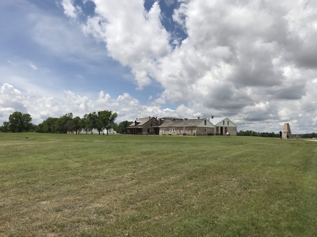
My first stop was the Fort Laramie National Historic Site. The grass really smelled sweet there. Of course, I hit the visitor center and watched a great NPS video.
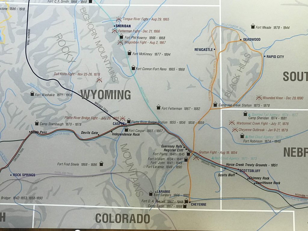
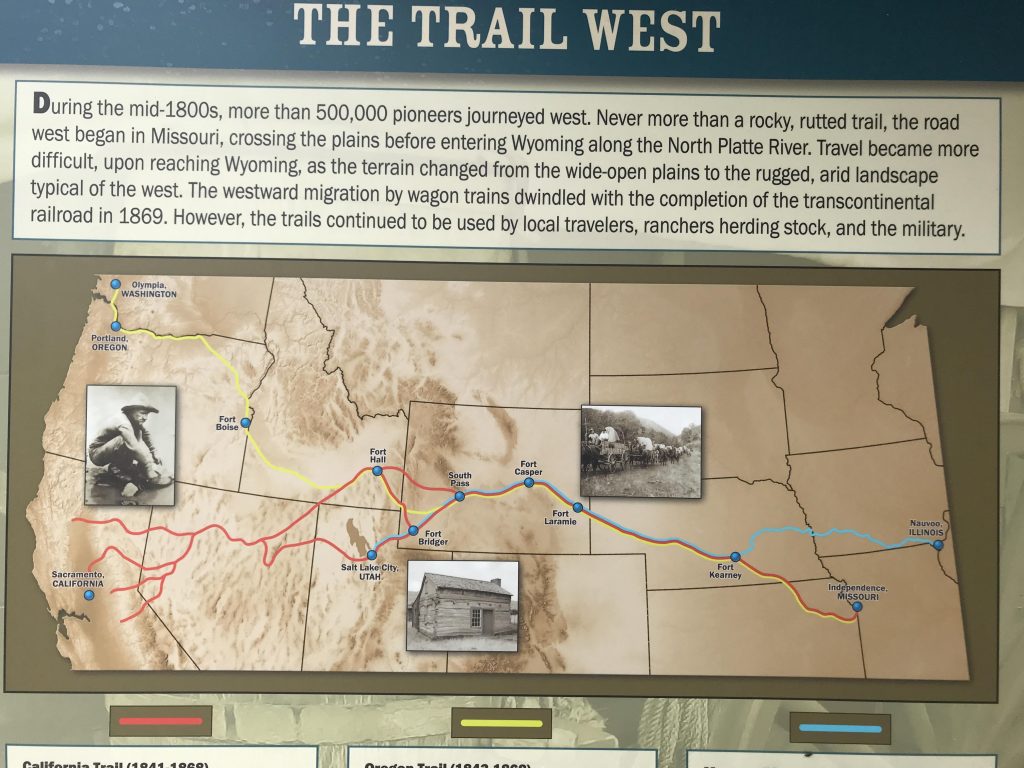
Significant trail spots in Wyoming
Fort Laramie was established at the confluence of the Laramie and North Platte Rivers. It was a rest and provisioning stop for tens of thousands of emigrants enroute to Oregon, California, and the Salt Lake Valley. It also was significant in the fur trade and in negotiations and conflicts with Native Americans. It started as a private trading post, then was acquired by the US Army in 1849.
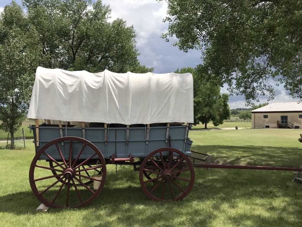
Fort Laramie National Historic SiteWagon, Fort Laramie National Historic Site. Historic object? Fake? I don’t know
This covered wagon looked small to me, but the park ranger said it was the size of some of the actual wagons. Some were bigger.
Had a picnic in the tree-shaded picnic area, with historic fort buildings in view. Lots of birds.
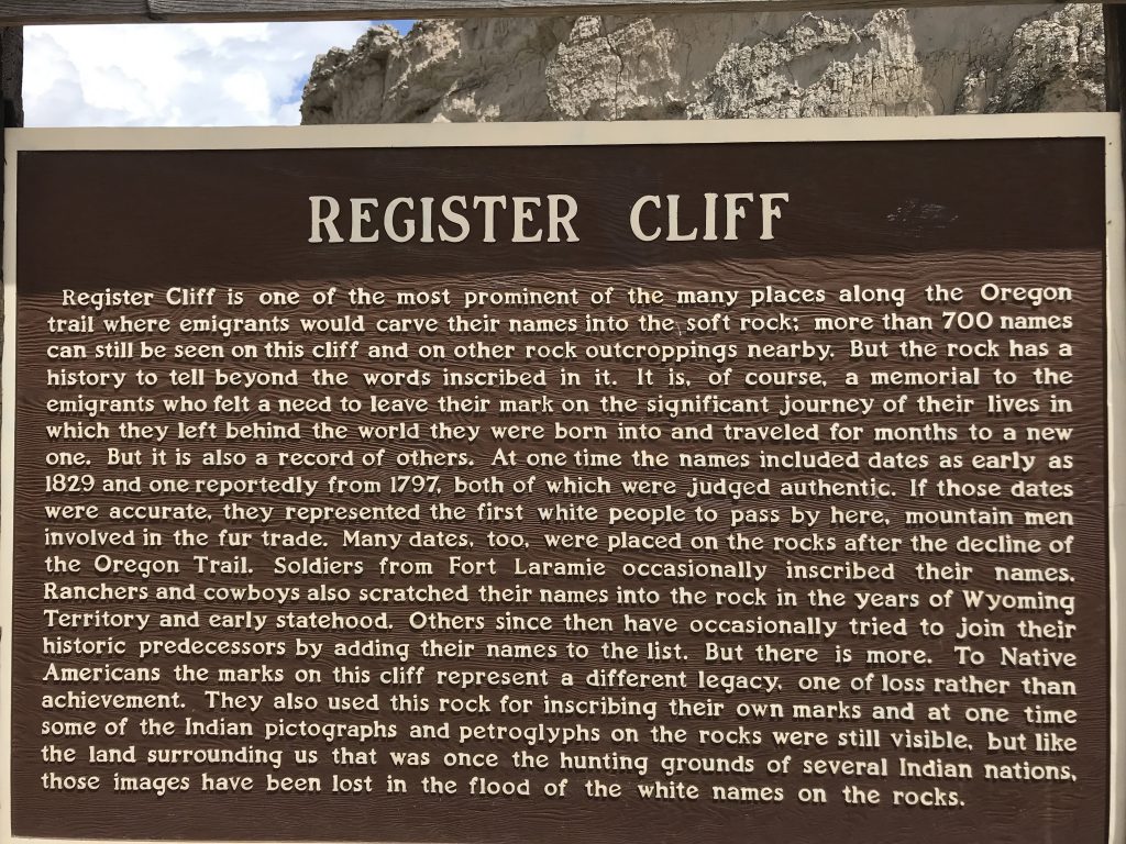
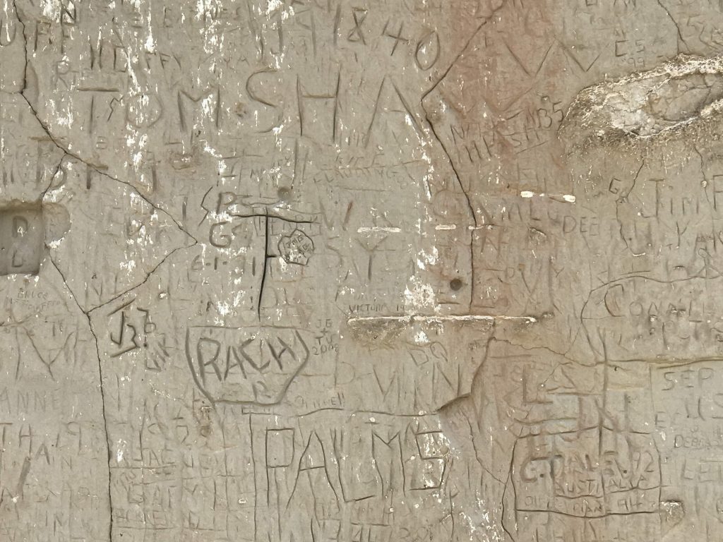
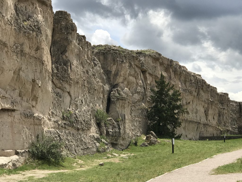
The next stop was close by. Two trail landmarks in Guernsey, Wyoming – Register Cliff and the Guernsey Wagon Ruts.
Sadly, there are so many recent inscriptions I couldn’t see any definite emigrant inscriptions. I had the place to myself most of the time I was there. Register Cliff is very near the North Platte River (no accident, the trail followed the river). I shot a short video.
Twenty seconds of North Platte River serenity, recorded by your diarist
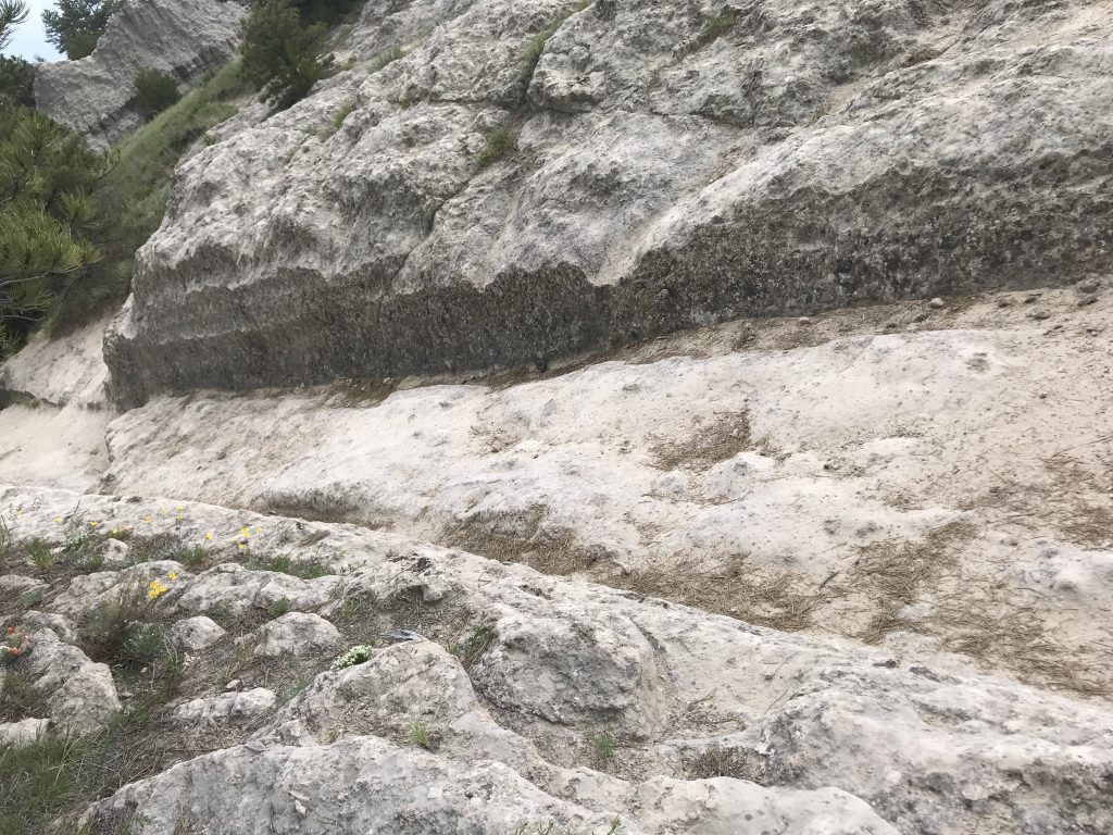
I went to the Oregon Trail Ruts State Historic Site. The ruts resulted from years of wear (in the sandstone) by iron wagon-wheel tires, and from intentional cutting by emigrants attempting to ease the grade up from the level of the river nearby. Source. The emigrants considered it safer to struggle up the slope than to cross the river.
Trails map & info Wagon ruts, Guernsey, WY
The wagon ruts were strangely compelling. I didn’t want to leave the ruts I had come so far to see, but it started to rain, and thunder sounded threatening.
Got to Casper. A huge rainstorm broke out just as I got to the hotel.
Father’s Day. Left a Happy Father’s Day to my Dad on Facebook. In the elevator I saw a dad with two adorable boys and wished him happy Father’s Day.
Sweatshirt weather. Loving it.
Left Silverthorne. Went through the Eisenhower Tunnel, which takes I-70 under the Continental Divide. (I was recrossing the Divide here from West to East.)
In Denver, I did what I did in Philadelphia and Atlanta – passed through without stopping.
Stopped in Welby at Mr. Egg for an early lunch. Waited outside for a while for a table. The food was fantastic. I had a vegetable omelet that came with pancakes.
The very northern part of Colorado is different — it’s rolling grasslands.
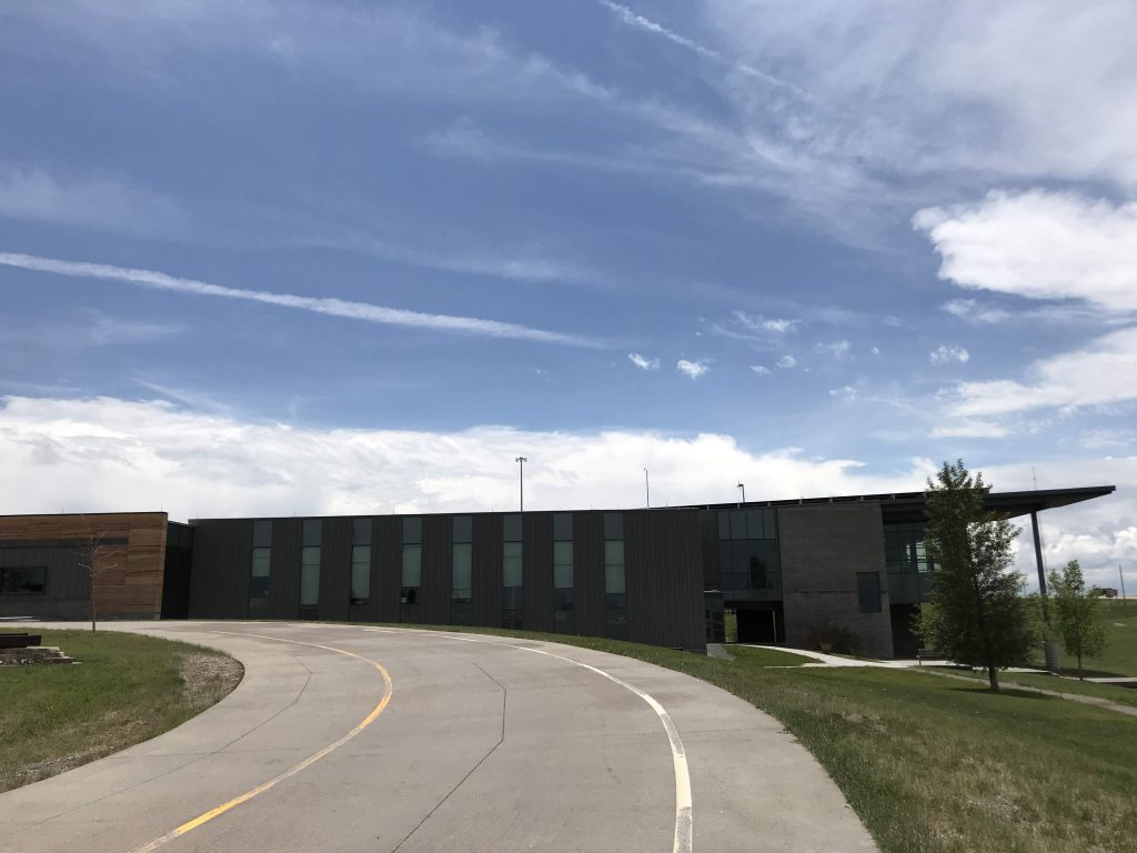
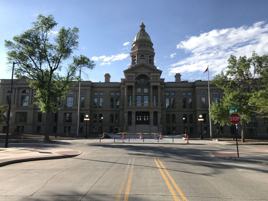
Crossed into Wyoming and went to the state welcome center. Got out of the car and was hit with a pleasant smell of grass. The Southeast Wyoming Welcome Center is a lavish building. Clearly no expense was spared. It’s a postmodernist building with a cantilevered prow built in 2012. The architect was Anderson Mason Dale Architects.
Southeast Wyoming Welcome Center, outside Cheyenne. I couldn’t get far enough away to get the whole building in the frame.
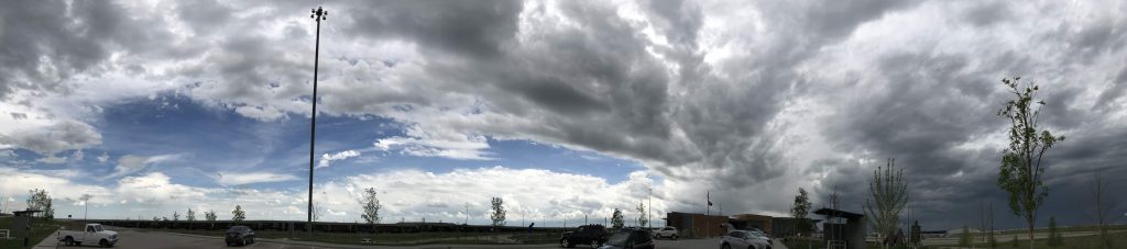
It sits on 26.2 acres of grassland, donated to the state by Neil McMurry, with a huge bowl of sky above it.
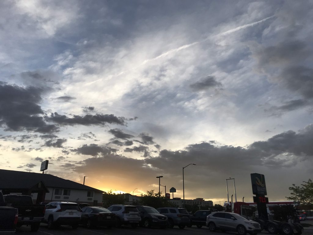
Sky at the Welcome Center
After checking in to my hotel, I drove to downtown Cheyenne. True to form, there was no one on the streets. This happened in many cities but it was way creepier here. My outlook on cities is all wrong. I live in the city that never sleeps, but other cities sleep.
They have bike share, but you have to call up and give them your credit card. There is no app.
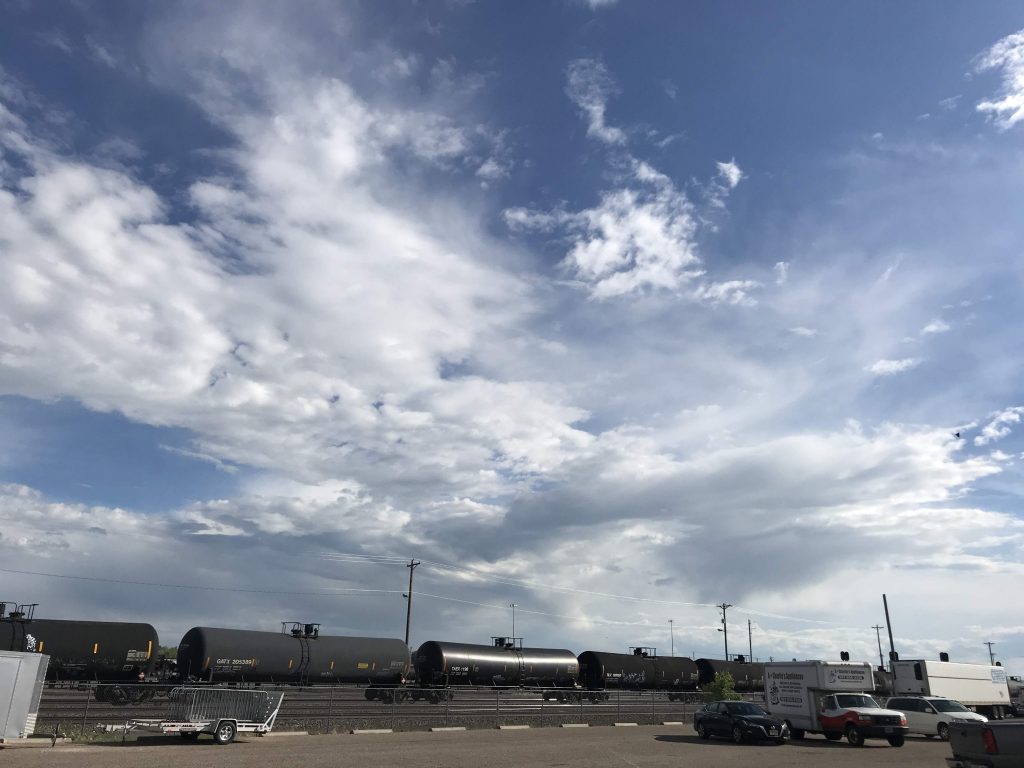
The railroad was important to the town’s history and it’s very prominent in town — runs right through the center.
Freight train, downtown Cheyenne
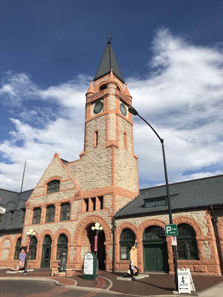
The lovely Union Pacific depot, built in 1886, is now a museum. The architect was Henry Van Brunt and the style is identified by a sign as Richardson Romanesque.
Former Union Pacific Depot (now Depot Museum), CheyenneWyoming State Capitol, Cheyenne
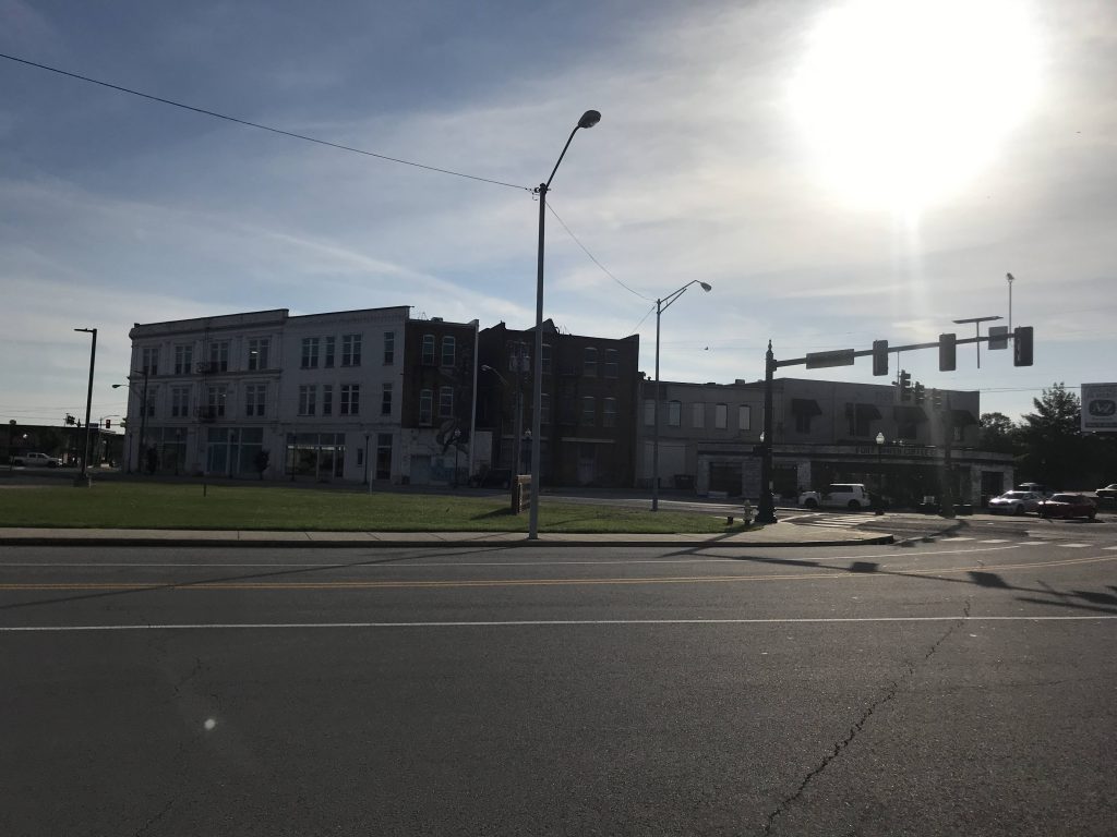
Most of downtown Cheyenne’s buildings are undistinguished.
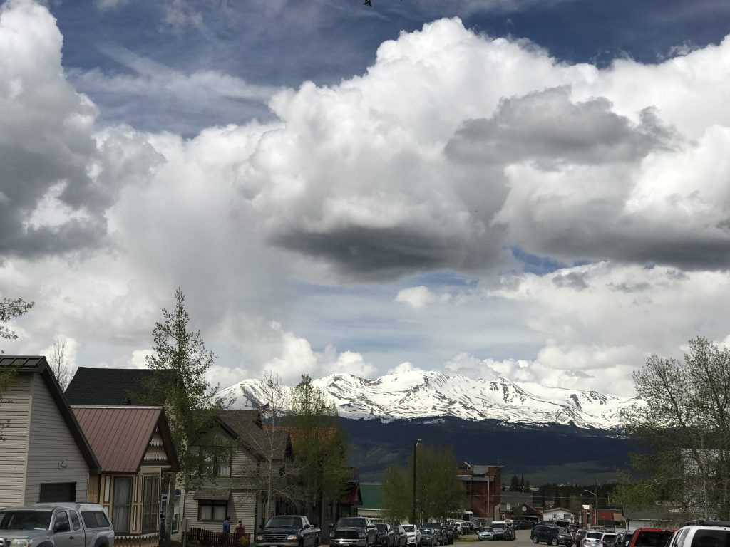
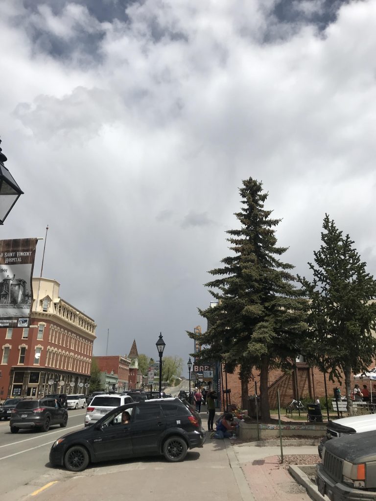
Drove to Leadville, the highest city in Colorado at 10,151 ft. Took a walk down the main drag, Harrison Ave. Families with little kids, runners from a race, tourists like me, and maybe a few locals. Sat on a bench and watched the world go by.
Leadville, COLeadville, CO
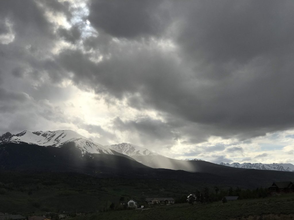
Without being aware of it, I crossed the Continental Divide here from “East” to “West.” Here, the Divide itself goes east/west, so the crossing is south to north. I went over Fremont Pass, 11,318 feet. There was a sign identifying Fremont Pass, but it didn’t say it was on the Continental Divide.
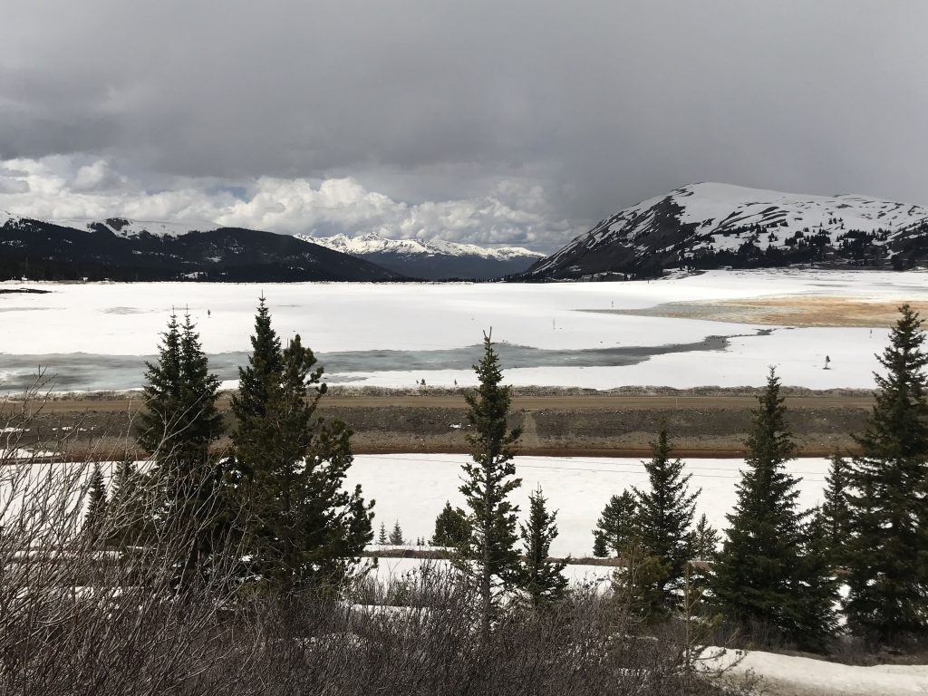
After Fremont Pass, I stopped at a field of snow. It once was a valley that contained three mining towns. When the mining industry went bust after the Second World War, the towns were abandoned and the valley was filled with mine tailings (the waste portion of ore produced by mining). Then they created a meadow on top. They call it the Valley of Ghosts.
Snow at the “Valley of Ghosts,” near Leadville
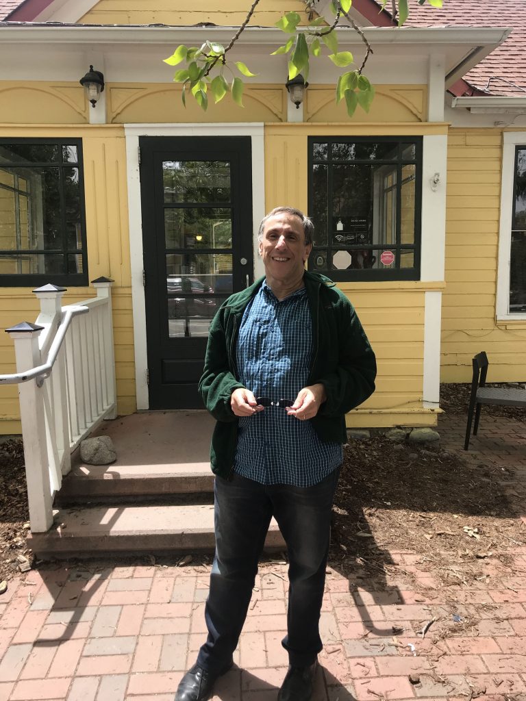
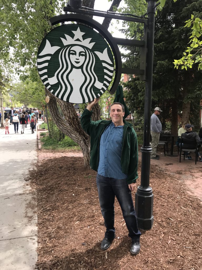
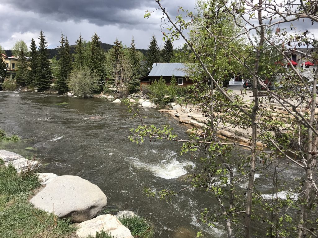
One of my bucket list items on this trip was visiting the world’s highest Starbucks (9,600 ft.) in Breckenridge. When I got to Breck I immediately went there. It’s in a little yellow house and it is really cute.
I asked a manager-looking guy if this is the world’s highest Starbucks. He immediately said there is some dispute about that, because there is one in Taiwan on the 35th floor of a building, and there is one on a mountain in Utah, but it’s not a freestanding Starbucks, it’s a restaurant that serves Starbucks coffee. So if you only count “real” Starbucks this is the one. I’m so happy someone who works there knows about it. I ordered a tall caramel macchiato.
At the world’s highest Starbucks, Breckenridge, COAt the world’s highest Starbucks, Breckenridge, CO
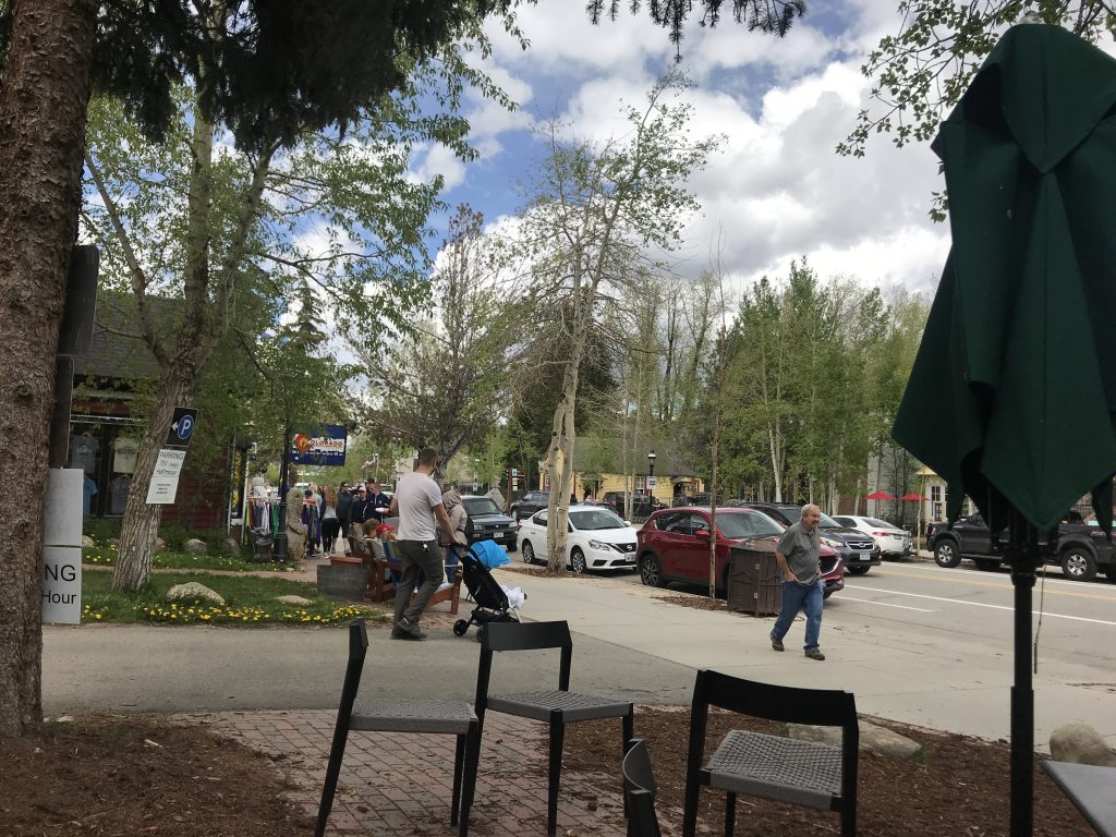
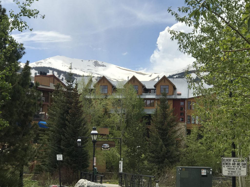
Took a walk around Breckenridge.
Main St., BreckenridgeBreckenridgeThe Blue River, Breckenridge
Drove to Silverthorne, to my hotel. For dinner I went to Cheba Hut Toasted Subs, a sandwich chain only in the West. I had a fantastic sandwich, and they have a fun attitude. Also a full bar. Wish they’d come to New York.
Left my hotel in Pueblo a little later than normal.
Thought about what Blake said about kissing the joy as it flies. I am feeling joy, but I know it’s not going to last forever. I can’t hold onto it, so I kiss it as it flies.
I listened to the Gram Parsons song “Return of the Grievous Angel.” Emmylou Harris and Gram’s voices sound sublime in harmony.
Out with the truckers and the kickers and the cowboy angels And a good saloon in every single town
‘Cause I headed West to grow up with the country Across those prairies with those waves of grain And I saw my devil, and I saw my deep blue sea And I thought about a calico bonnet from Cheyenne to Tennessee
Went to Royal Gorge Bridge. I didn’t know before that the bridge was a tourist attraction not used for actual transportation. I quickly realized as much when I got there and found out you couldn’t even see the bridge without paying $28. I used the men’s room for $0 and left.
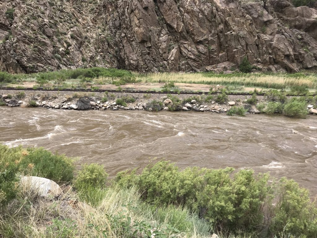
Going west on US 50, the road is right alongside the upper Arkansas River. The river has white water, and I saw some people rafting.
Upper Arkansas River, near US 50
Stopped at the Cotopaxi general store. I love the cowboy West. It’s so relaxed.
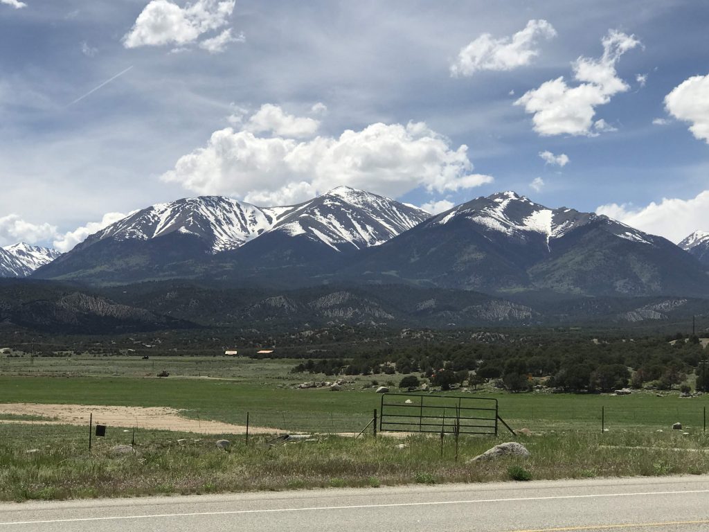
Cotopaxi Store, Cotopaxi, COMountains near Salida, CO
Got to my hotel, the Surf Hotel in Buena Vista (alt. 7,965).
I didn’t know any of this when I booked, but the hotel is in a new part of town called South Main that was designed according to New Urbanist principles.
The site is a one-time garbage dump that had sat vacant for years. It came up for sale about a decade ago.
The developers, Jed Selby (a world-class kayaker) and his sister Katie, called in a team of architects and planners and invited the community to be involved in the planning process. They established key principles including:
Maintaining public access to the river; creating a high-quality riverfront space; establishing visual and physical connections with Main Street and downtown Buena Vista including a dramatic view of a historic cupola with background mountains; and creating a walkable neighborhood through a mixture of uses, network of pedestrian connections, and human-scale streets.
There were people playing frisbee and throwing footballs on the green.
The green and some outdoor living-room furniture, South Main, Buena Vista, CO
The streets are woonerfs – spaces shared between slow-moving cars, bikes, and pedestrians.
This is really beautiful, I am privileged to be here. And it’s by chance. So it isn’t Disney World, it’s more like… Celebration, without Celebration’s problems.
The hotel is right next to the Arkansas River, and you can hear the loud sound of the rushing water. Its façade is made out of different size rocks.
Surf Hotel, Buena Vista, CO. My room fronted on one of those continuous balconies.
It’s a super-hipster boutique hotel. I like it. I wonder if Mary Beth would like it or if she would see it as too precious.
Lobby bar, Surf Hotel, Buena Vista, CO
In my room, the bathroom is gorgeous – marble sink and a stall shower. Instead of plastic or coated paper cups in the guest rooms, they have enamelware cups. And a metal ice bucket.
I went to the real downtown of Buena Vista and it’s adorable. I see what they mean when they said they were inspired by downtown to build South Main.
Thinking back, like to Virginia and North Carolina, I’m already feeling nostalgic for the early part of this trip. It has truly been an epic journey, a voyage of discovery. And it’s not over.
In the morning in Clayton (alt. 5,056), 51 degrees and breezy! Loving it! A beautiful day.
Sunrise, Clayton, NMMorning, Clayton, NM
Back to Oklahoma and visited Kenton, the westernmost town in that state. Tidy little town with one store (the Kenton Merc) that was closed, and three B&Bs.
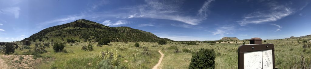
I drove to Black Mesa Nature Preserve, to the trailhead for the highest point (4,973 feet) of Oklahoma. It’s a four-hour round trip hike to the summit, which I skipped. Beautiful spot. Hilly, unlike most of the Panhandle.
Panorama: Black Mesa, OK. It’s a lot bigger than this makes it look.
I decided my tribute to Black Mesa would be having a picnic lunch there.
Later, great fun bombing down a two lane road with beautiful scenery all around, and no one else on it. The radio had a report on corn, wheat, and cattle futures.
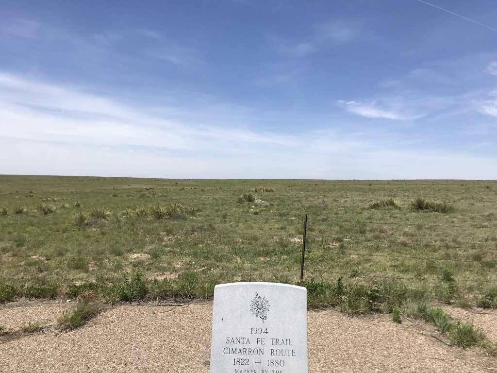
Got out at a Santa Fe Trail historical marker – the wind was something fierce. The historic trails are very important here and they are commemorated by signs, markers, and street names. The Santa Fe Trail was used for trade (before the Mexican War, between the U.S. and Mexico) and was a two-way trail, unlike the emigrant trails (the Oregon, the California) which saw one-way traffic.
Santa Fe Trail marker, Oklahoma Panhandle
I continued west, then turned north. My route is taking a big S-curve because I’ve been to New Mexico and Arizona, and I want to visit Colorado, Wyoming, and Idaho. Got my first exciting sight of snow-topped mountains, then entered Colorado.
Some Colorado facts I find interesting: That state, formerly reliably Republican in presidential voting, has voted Democratic in the last three presidential elections (Obama twice, Hillary). The highest city in the state is Leadville at 10,200 feet; highest town is Montezuma at 10,335 feet.
Trinidad, Colorado is a charming town with some historic buildings. I saw about eight marijuana shops (probably because it’s so near the state line). I’m not planning to use any cannabis on this trip (or at any other time).
Saw a sign on the highway for the Ludlow Massacre memorial. The Ludlow Massacre took place on April 20, 1914, when the Colorado National Guard fired machine guns into a tent colony of striking coal miners and their families at Ludlow, Colorado. 21 were killed. It was part of what’s called the Colorado Coal Wars. The workers’ demands were for an eight-hour day and for the company to follow mining regulations. At that time, the local legal and political systems were under the control of the mine owners.
Arrived in Pueblo (alt. 4,692). On the side of I-25 in Pueblo, I saw what looked like a huge disused factory. Turns out it is in use. It’s the Pueblo Steel Mill, built in 1881, owned since 2007 by Evraz Group of Russia.
By chance, this is my fourth stop on the Arkansas River! Little Rock, Fort Smith, Tulsa, Pueblo. I may yet see more of the Arkansas River.
I’m struck by how nice everyone’s been on my trip. Americans are great. They are an open, friendly, helpful people.
Had a great veggie burrito for dinner at a place called Habanero’s. Zero atmosphere and great food.
Loving the freedom of this trip. The freedom to go wherever I want.
In the OK PanhandleGrain elevator, Guymon, OK
Back in Oklahoma, stopped at a coffee shop, Urban Bru, in the tiny Panhandle town of Goodwell. When I got there, there were a few young men customers, one wearing a cowboy hat. The barista was really nice and let me stay a long time and use the wifi to do yesterday’s post.
Went to the No Man’s Land Historical Museum, also in Goodwell. Beautiful and tranquil outside. Seth Hammond, a docent, gave me a long disquisition on the history of the area.
Facts about the Oklahoma Panhandle I got from wall text:
The Panhandle is semi-arid. Despite looking flat, it slopes upward from 2,000 feet to almost 5,000 feet from east to west. Its land area is 8% of Oklahoma’s area but it has less than 1% of the state’s population. Mainstays of the Panhandle economy are agriculture, stockraising, and oil and gas production. Its population was 30,000 in 1980. Population density of the entire state is 44 people per square mile, while density of the Panhandle counties is: Beaver Co. 4, Texas Co. 9, Cimarron Co. 2. Annual rainfall is 15-20 inches, most in late spring and summer.
The museum is basically a storehouse of stuff of varying interest. I love railroad history and there was some of that.
I drove to the CO-KS-OK tripoint. Some of that time, I was driving on a dirt road following the KS-OK state line. The last 8 miles were dirt road.
I was excited to find the tripoint marker. It’s a small black disk set right into the road. Paved here, so no one steals it.
Marker at the CO-KS-OK tripoint My car, Large Marge, parked at the tripoint (I named her that because her license plate is P56 LGE)
The tripoint was great, but it was after that my troubles began. I could have just backtracked the 8 miles but instead I foolishly let Google route me. It led me on a merry way onto one dirt road after another. Finally, it led me to one that was so bad and so uneven and went through a farmer’s field that I couldn’t take it and I had to backtrack. Then my phone fell under the driver’s seat and I had to look for it. Luckily I had a pen light. Then, just using GPS and the map, I found my way back to a paved road. Whew! When something goes wrong on a trip I call it a “travel story” and this definitely was one. Lesson learned: Always check the directions before starting. And for Pete’s sake do what makes sense.
On emerging from that nightmare, I drove to Boise City, OK (without Google navigation).
A “car wash” in these parts isn’t the same as one where I live. Here, it’s self-service. You put four quarters in, and use a powerful wand to first soap, then rinse, your car. Then you just drive it into the sun to dry it. You can buy a cloth for more quarters. I gamely did it.
Visited the Cimarron County courthouse.
Clouds, Boise City, OK First State Bank, Boise City, OKCimarron County Courthouse (built 1928), Boise City, OK
Entered New Mexico, state #18 for the trip. (I went there due to the lack of hotels in the OK Panhandle.)
Motel painted turquoise. Because we are in New Mexico!
I crossed into Mountain Time and gained another hour. Drove to my hotel in Clayton.
The title of today’s post is a quote from “The Idea of Order at Key West” by Wallace Stevens.
Finally a beautiful day. It is 75° with humidity 40%. I am out of the punishing heat of the South.
CVS has made this trip a lot easier by being everywhere and having everything.
Still in Enid, I went to the Cherokee Strip Regional Heritage Center. The Cherokee Strip, officially the Cherokee Outlet, was a large area of land in present-day Oklahoma that the US Government obliged the Cherokee Indians to take in exchange for their lands in the Southeast. They were permitted to use the land but not to live there (they lived nearby).
As often happened during the settling of the United States, there arose pressure from whites to settle the land. The Cherokees were forced to sell, and in 1893 there was an enormous land run to allow whites to settle there. Enid itself sits in what was the Cherokee Strip.
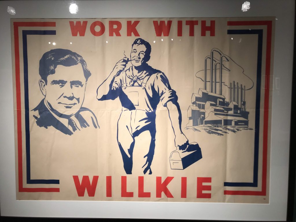
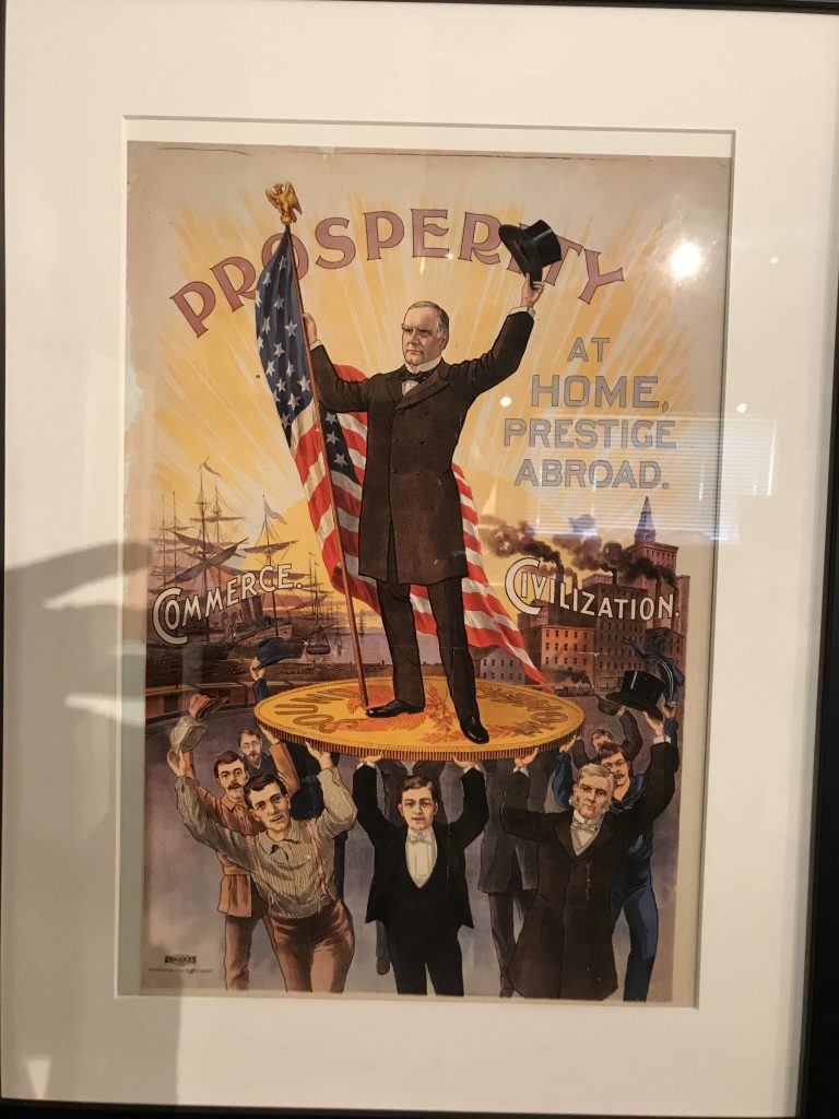
First I looked at their awesome exhibition of political posters.
Poster for Wendell Willkie, 1940Poster for William McKinley, 1900
The museum’s permanent exhibition is a lavish and extensive history of the Cherokee Strip and Enid.
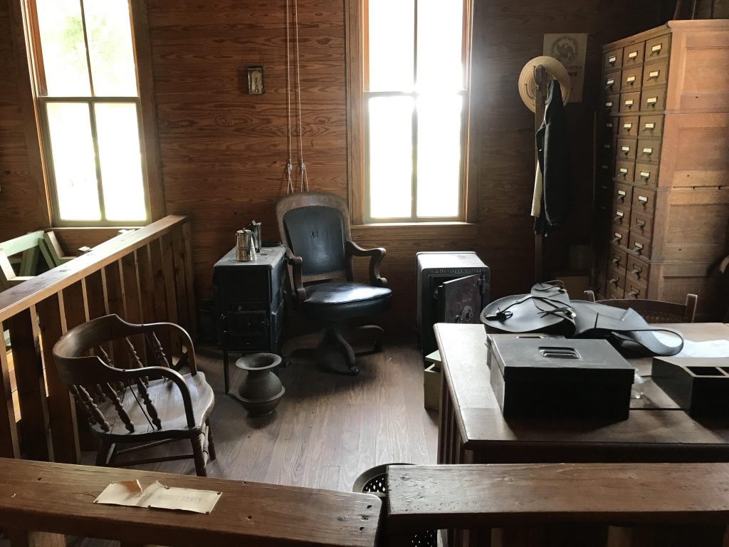
Sometimes people ask me, like they did at the museum, where I’m from. When I tell them, they ask what I’m doing here. So I told them about my trip and they loved it. They introduced me several times as the person from New York. Their archivist, Aaron, gave me a special tour of the historic buildings on the site, including the original Enid land office from the 1890s.
Land office, 1890s
Goodbye, Enid, lovely city where people are so nice. Pushed further west.
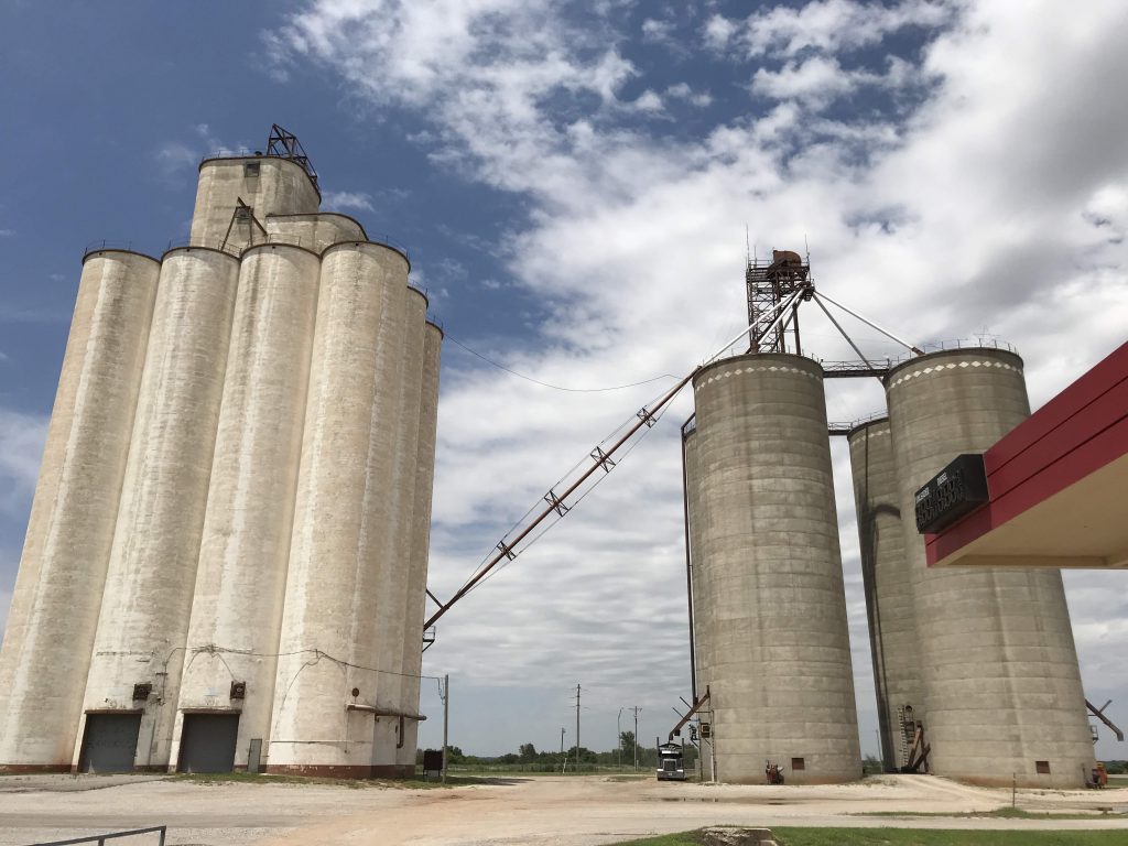
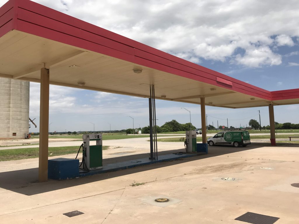
Grain elevators, sometimes called “cathedrals of the plains.” They are by far the tallest structures in the Oklahoma Panhandle Abandoned gas station
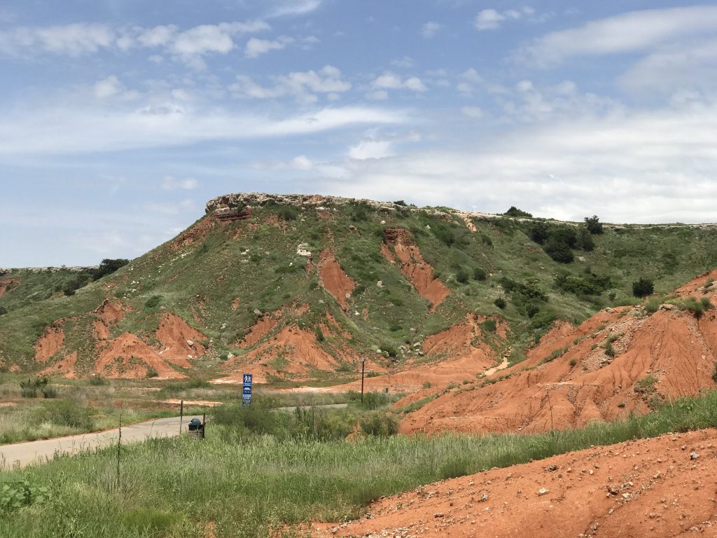
Passed through Gloss Mountains, red mesas that suddenly stick up from the prairie floor.
In the Gloss MountainsThe road
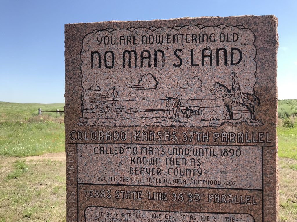
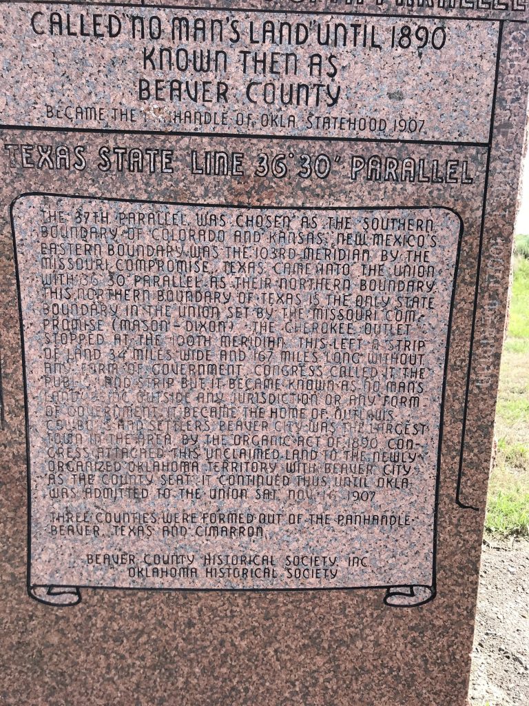
Finally, I entered the Oklahoma Panhandle, one of the main destinations on this trip, and a place I’ve wanted to visit for years. There’s a little monument on US 64 at the Panhandle’s boundary. (Before Oklahoma statehood, the Panhandle was known as No Man’s Land.)
No Man’s Land monumentText: The 37th Parallel was chosen as the southern boundary of Colorado and Kansas. New Mexico’s eastern boundary was the 103rd Meridian by the Missouri Compromise. Texas came into the Union with 36° 30′ Parallel as their northern boundary. This northern boundary of Texas is the only state boundary in the Union set by the Missouri Compromise (Mason – Dixon). The Cherokee Outlet stopped at the 100th Meridian. This left a strip of land 34 miles wide and 167 miles long without any form of government. Congress called it the Public Land Strip, but it became known as No Man’s Land, being outside any jurisdiction or any form of government. It became the home of outlaws, cowboys, and settlers. Beaver City was the largest town in the area. By the Organic Act of 1890 Congress attached this unclaimed land to the newly-organized Oklahoma Territory with Beaver City as the county seat. It continued thus until Oklahoma was admitted to the Union Sat. Nov. 14, 1907. Three counties were formed out of the Panhandle – Beaver, Texas, and Cimarron.
For comparison, Long Island is 118 miles by 23 miles maximum.
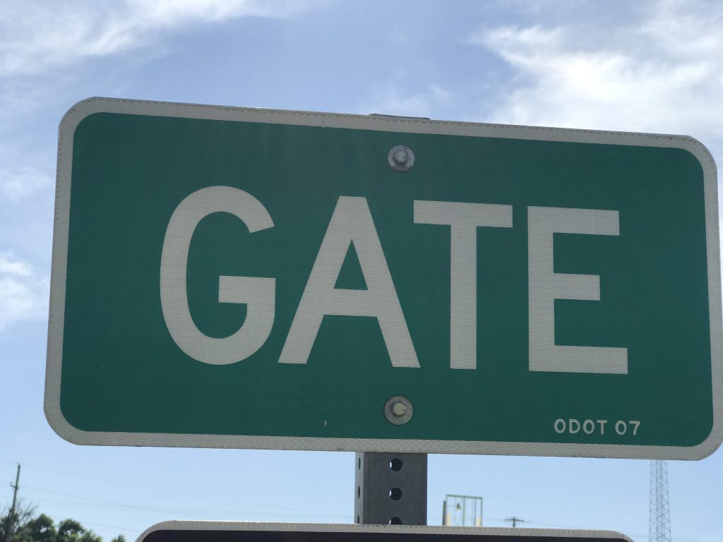
I arrived in Gate, Oklahoma. Stopped there mainly because of its name.
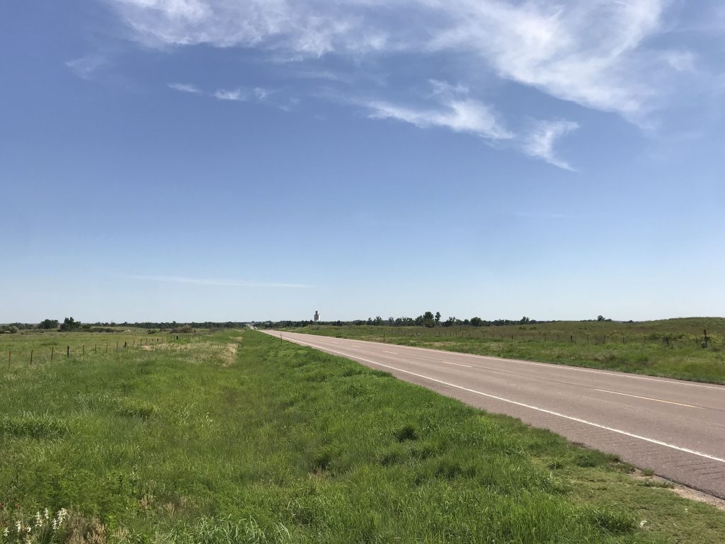
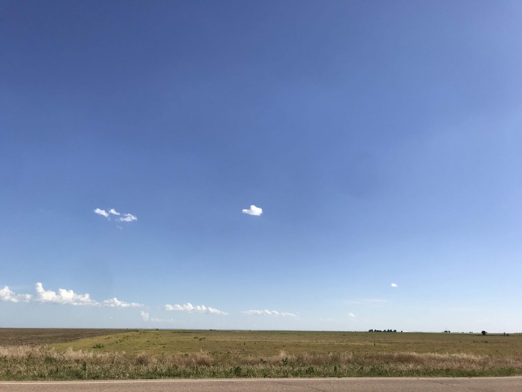
The Panhandle is flat and beautiful and mostly empty.
In the Panhandle
I entered a surprise new state, Kansas. I went there because the Panhandle is a little short on hotels.
Internet in my room wasn’t working, so I called the front desk and was told the whole town’s internet was down. What, no redundant connection? It was still down when I left in the morning.
Today is the midpoint of my trip – 19 days since I started, 19 days till I’m done. The midpoint of a trip usually represents the farthest away you get from home, and when you start returning home. In this case, that isn’t true because I am flying home. But the midpoint symbolically means I am on the way home, since from now there is less of the trip remaining than the time I’ve already spent. It also means I am more than halfway to San Francisco and have traveled roughly half the miles I planned to travel.
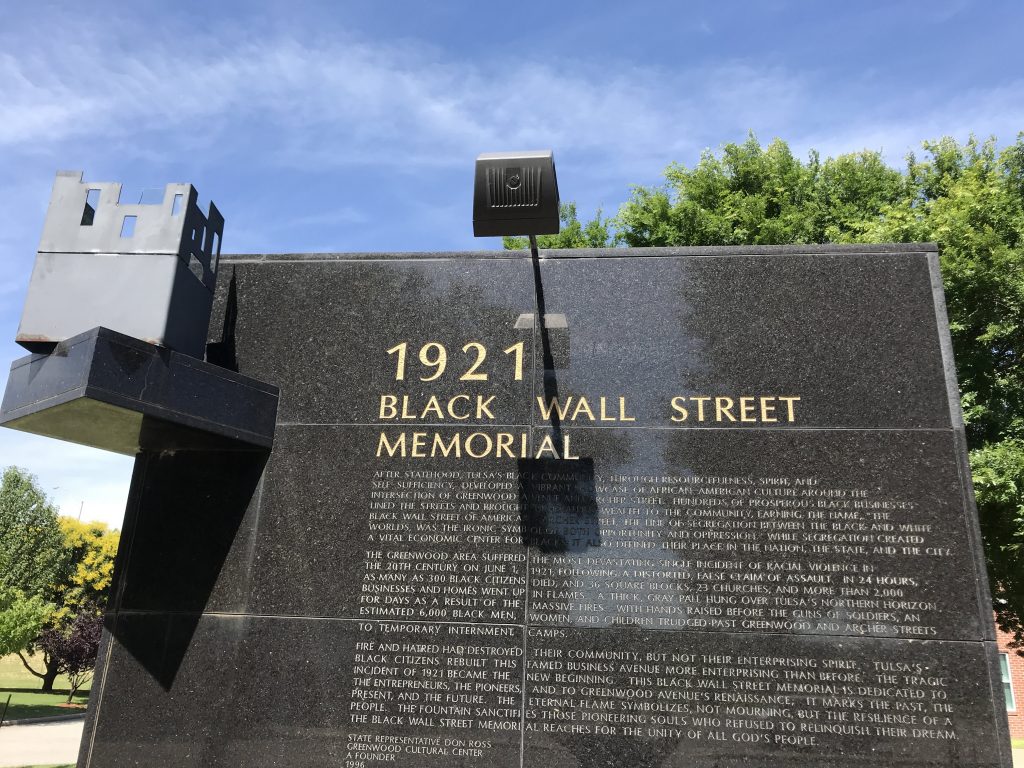
While in Tulsa, I considered it a must to observe the 1921 race riot.
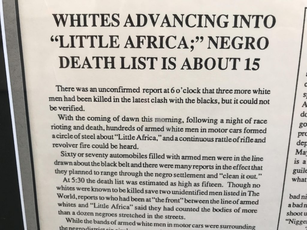
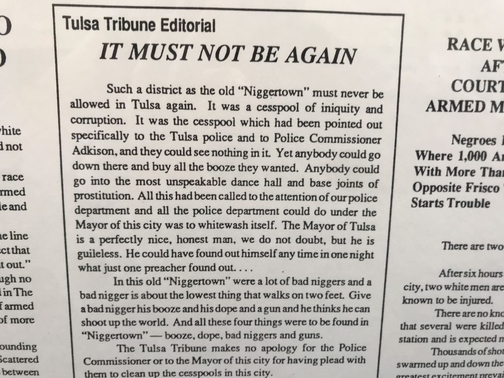
Over a night and day of violence on May 31 and June 1, 1921, armed white mobs indiscriminately shot African Americans in the then-prosperous Greenwood neighborhood (called the “Black Wall Street”), and set fire to black-owned businesses and homes. The death toll was about 300 African Americans. 10,000 were left homeless and 6,000 were detained in camp-like conditions for several days.
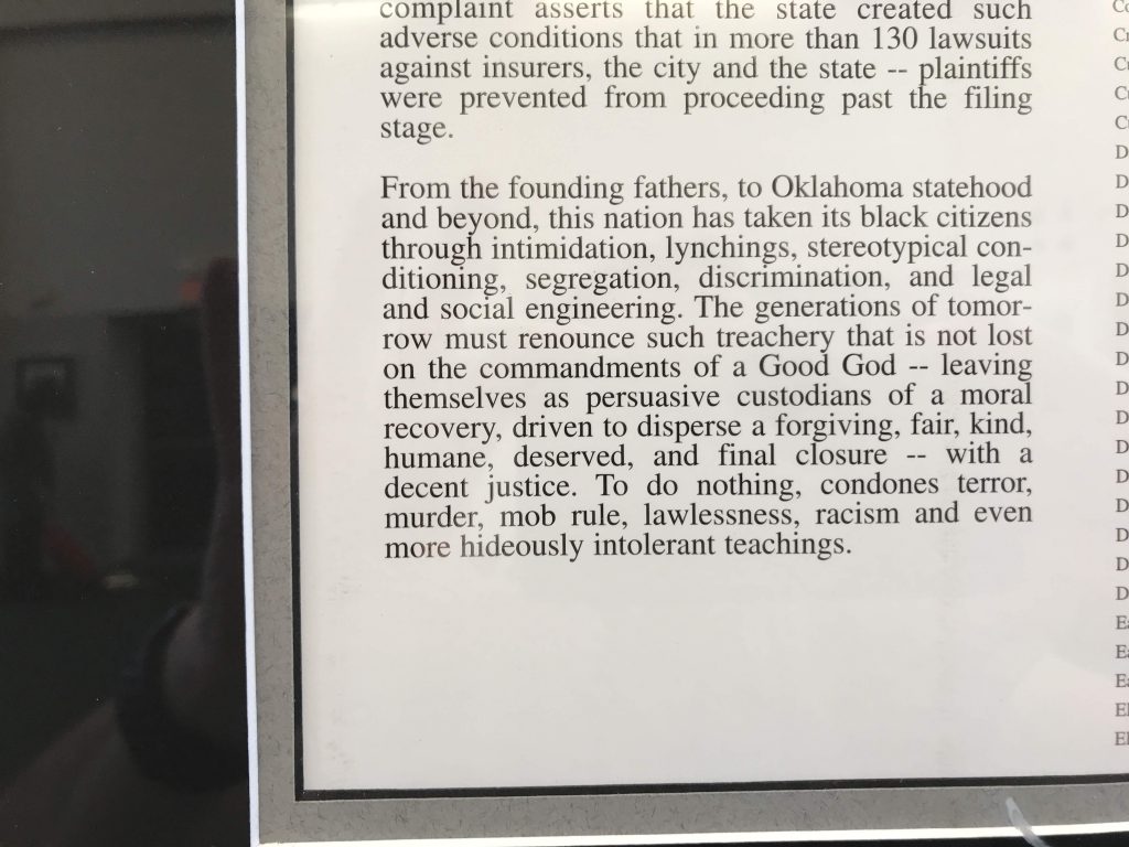
No one was ever charged for crimes committed during the riot. For 75 years, there was no public commemoration or apology. In the Tulsa city library, articles about the riot and the formation of lynch mobs were cut out of that day’s issue of The Tulsa Tribune. (Source: New York Times 5/31/1996). Only in the last 25 years have there been a few, still incomplete, efforts at commemoration and reconciliation.
To this day, and despite lawsuits, no compensation to victims has been paid, except for some 300 college scholarships awarded to descendants of survivors starting in 2003.
I went to the Greenwood Cultural Center, where they have a memorial and a historical exhibit about it.
Black Wall Street Memorial, Tulsa From a 1921 newspaperFrom a 1921 newspaperWall text
In the backyard of the center, happy black and white children were playing in the sun, a symbol of rebirth.
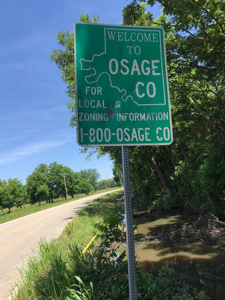
Drove north of Tulsa and into Osage County.
Saw a lot of oil drilling rigs.
Visited the Osage County Historical Society in Pawhuska. It was a little disappointing – it’s a museum of the county, not the Osage nation. There was as much about whites there as about Native Americans, if not more. I need to read more deeply to appreciate Native American history.
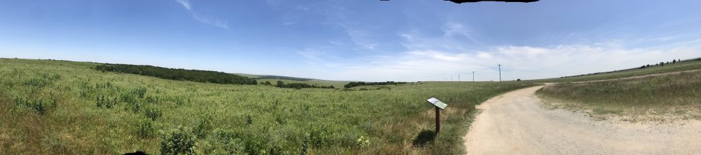
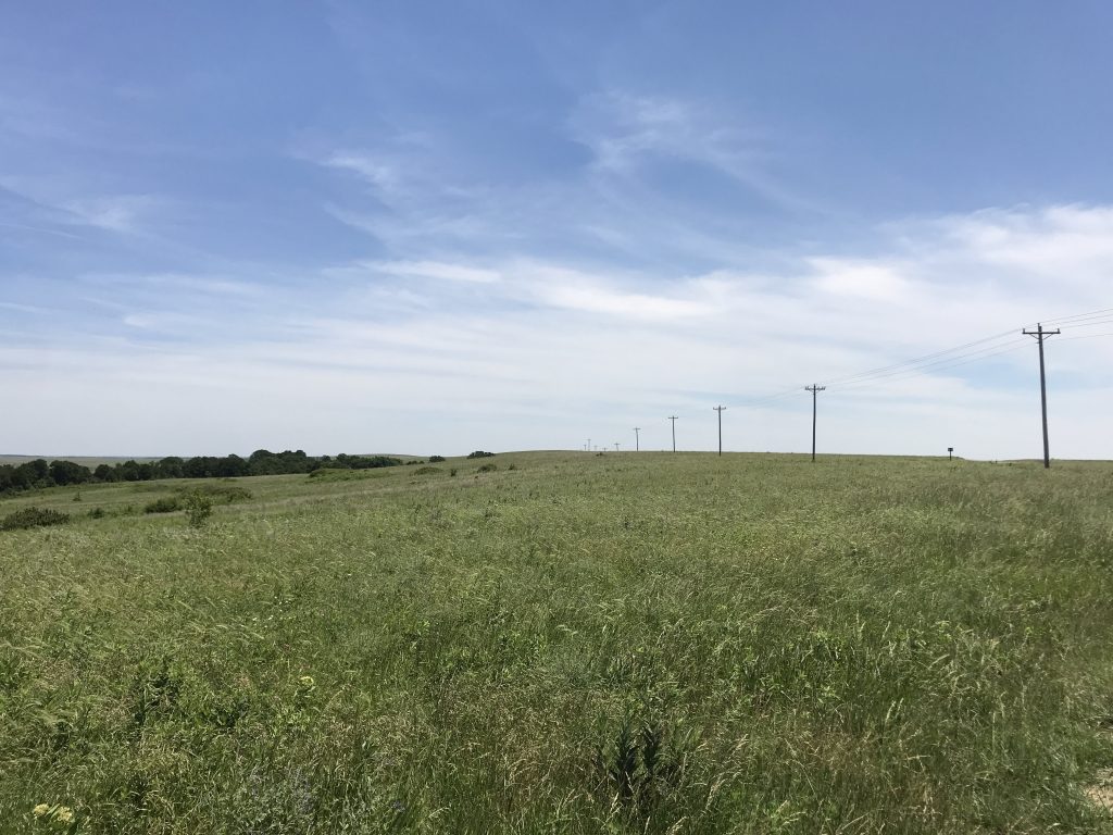
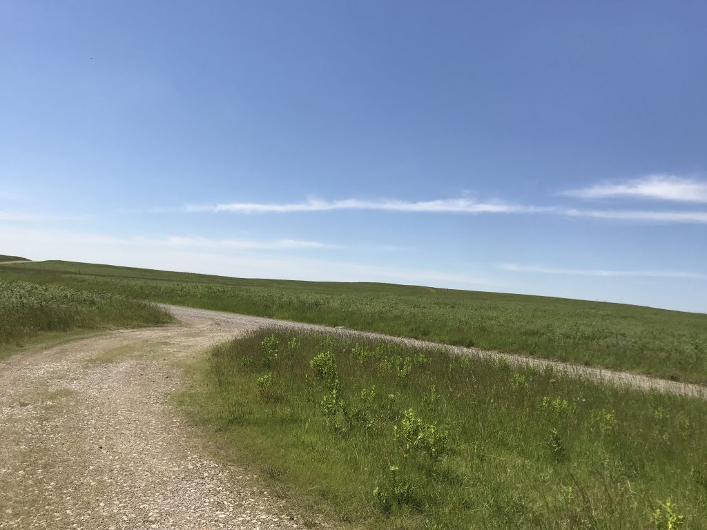
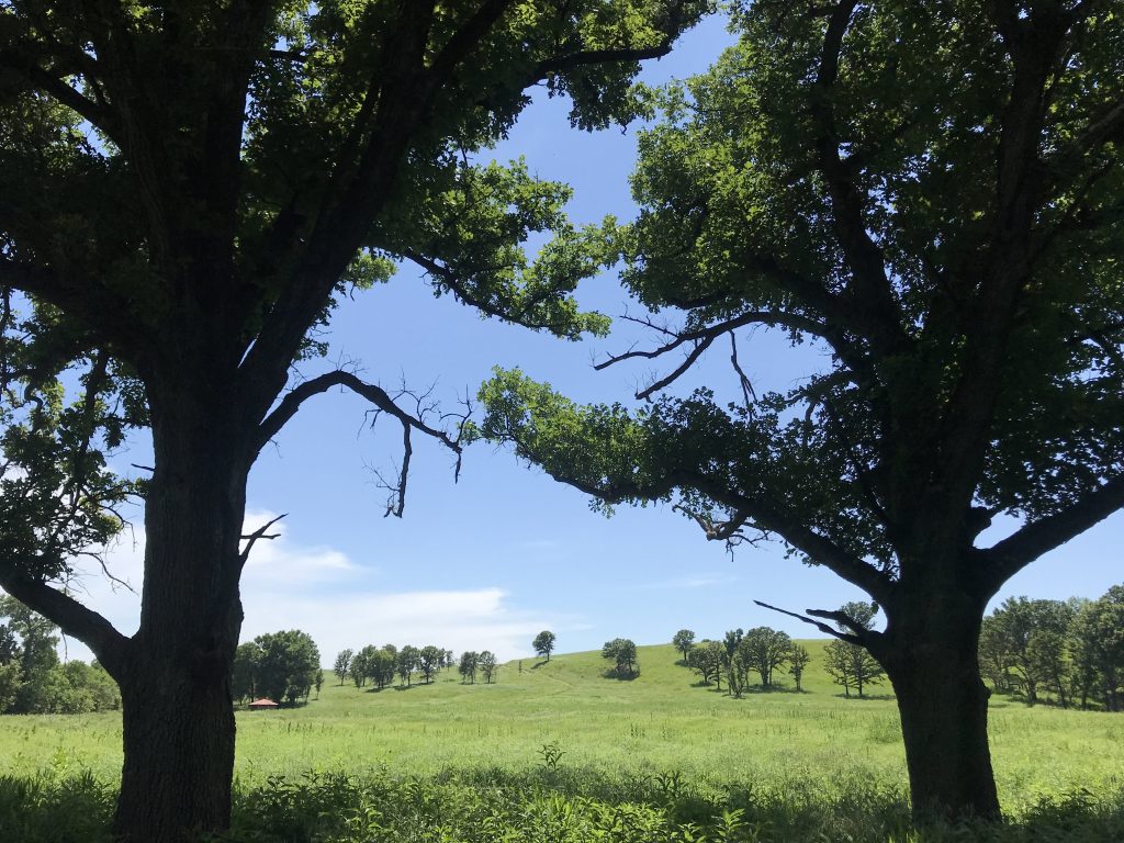
Next, to the Nature Conservancy’s Tallgrass Prairie Preserve, also in Osage County. This is what I came to Oklahoma for. Grassland going all the way to the horizon 360° around me, and for a while I couldn’t see any other people or cars. No sound but the wind.
Panorama: The grasslandsAt the PreserveAt the Preserve
The Tallgrass Prairie Preserve is the largest intact area of original tallgrass prairie left in the United States. Was happy to be there.
At the Preserve
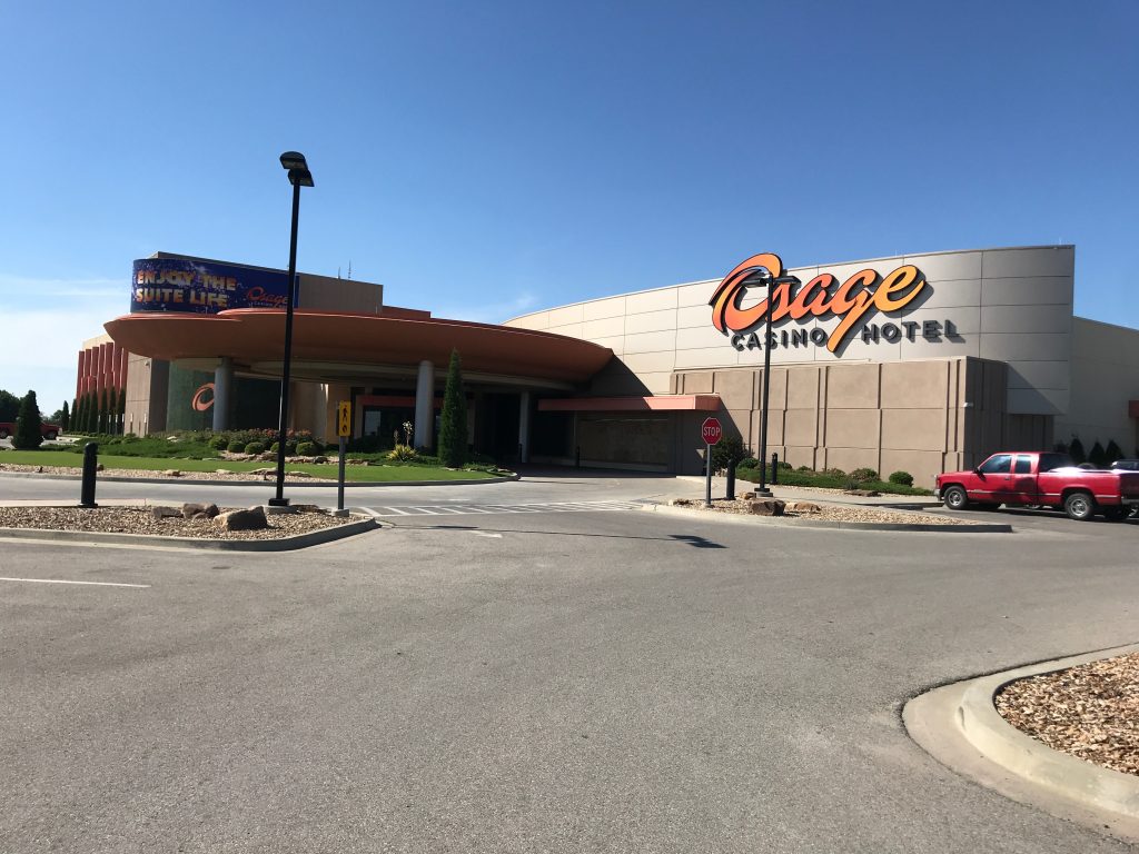
Left the preserve. I passed the Osage Casino in Ponca City and out of curiosity I went in. By Las Vegas Strip standards, it was small. It was mostly slot machines with a few customers, with an automatic craps table no one was using, and blackjack tables that no one was at. I didn’t make any bets.
Osage Casino, Ponca City
After that I passed about four more Native American casinos.
At 630 PM I got to Enid. Got a warm Western welcome at my hotel, Western Inn and Suites.
In 1928 (oil boom time), Frank Iddings wrote a song, “Enid, The City Beautiful” that went in part “You’re right in the center where the best wheat grows and you’ve got your share of the oil that flows.” (Wikipedia)
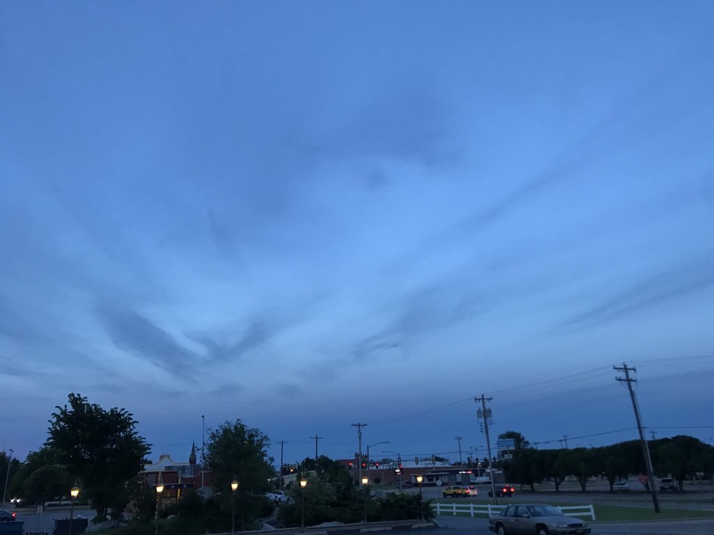
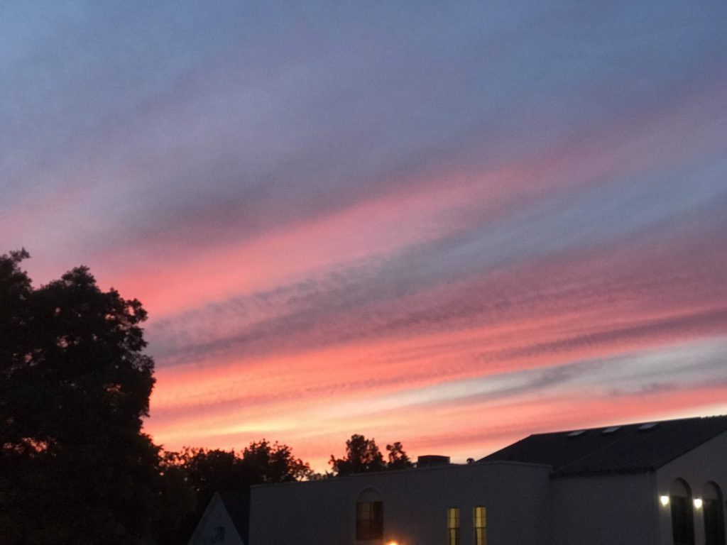
Night falls on EnidSunset, Enid
There was a breathtaking sunset. Sat outside the hotel for a while. The night was nice.
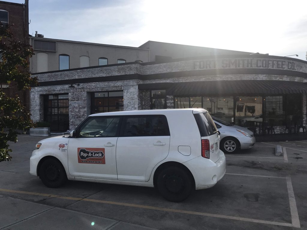
I found a hipster coffee shop, Fort Smith Coffee Co. It’s in a former gas station, in a lovely reuse.
Fort Smith Coffee Co. (originally a gas station)
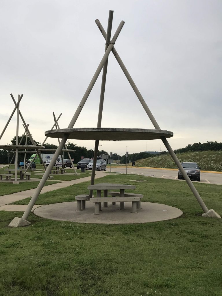
Left Fort Smith. Entered Oklahoma and stopped at the state welcome center.
Chair with “Oklahoma” fabric, state welcome center, Sallisaw, OK
It had concrete tepees with picnic tables in them and a roof over them. I stopped to eat a peanut butter sandwich. Very cozy being outside and inside at once.
Concrete tepees, state welcome center, Sallisaw, OK
Got to Tulsa and checked into the Tulsa Club Hotel, a former gentleman’s club built in 1926. The building closed in 1994, was renovated, and opened as a hotel on May 1, 2019, less than six weeks ago.
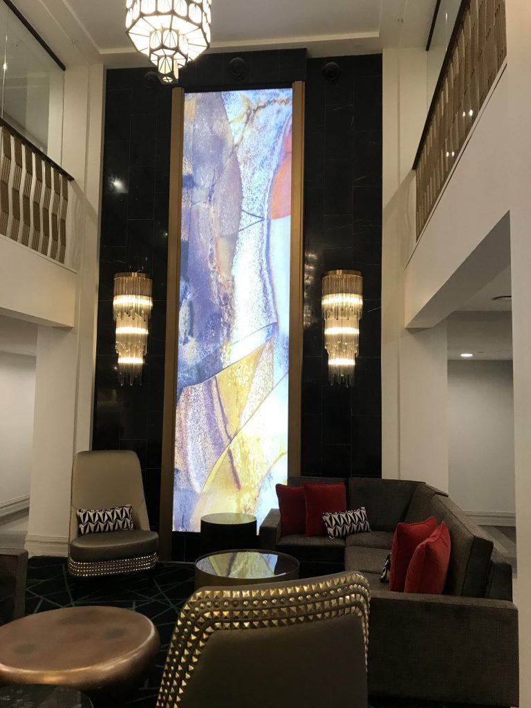
Lobby bar, Tulsa Club Hotel, Tulsa Lobby, Tulsa Club Hotel, Tulsa
The renovation job is beautiful, but the pictures are a little misleading. The lobby is very small, not befitting the lobby of a grand hotel.
I tried Tulsa’s bike share system. Got a bike and rode it around deserted downtown. Decided to ride down to the paths by the river. When I got close to the river, there were signs something was up – police barricades, lots of people. Turns out it was a three-day “cycling festival” called Tulsa Tough. When I arrived there was a race going on (Grand Prix-style, through the streets) and a huge street party.
Street party for Tulsa Tough raceThe flooded Arkansas River, Tulsa
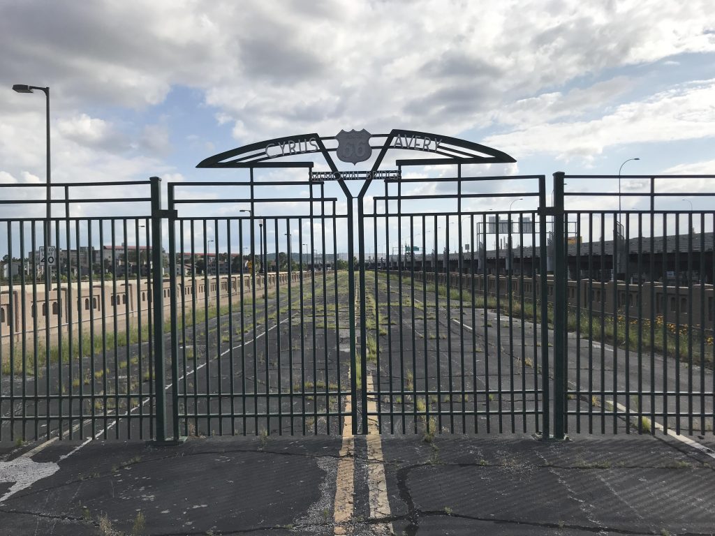
I pressed on to Cyrus Avery Centennial Plaza. It’s a tribute to Route 66 and to Avery, the road’s main creator and proponent, at the point where the route crossed the Arkansas River after passing through Tulsa. In Oklahoma they strongly embrace Route 66 and its mythos. There are plans for the plaza that include a visitor center and restaurants.
Cyrus Avery Memorial Bridge (Arkansas River bridge, former Route 66). Built 1915, now closed
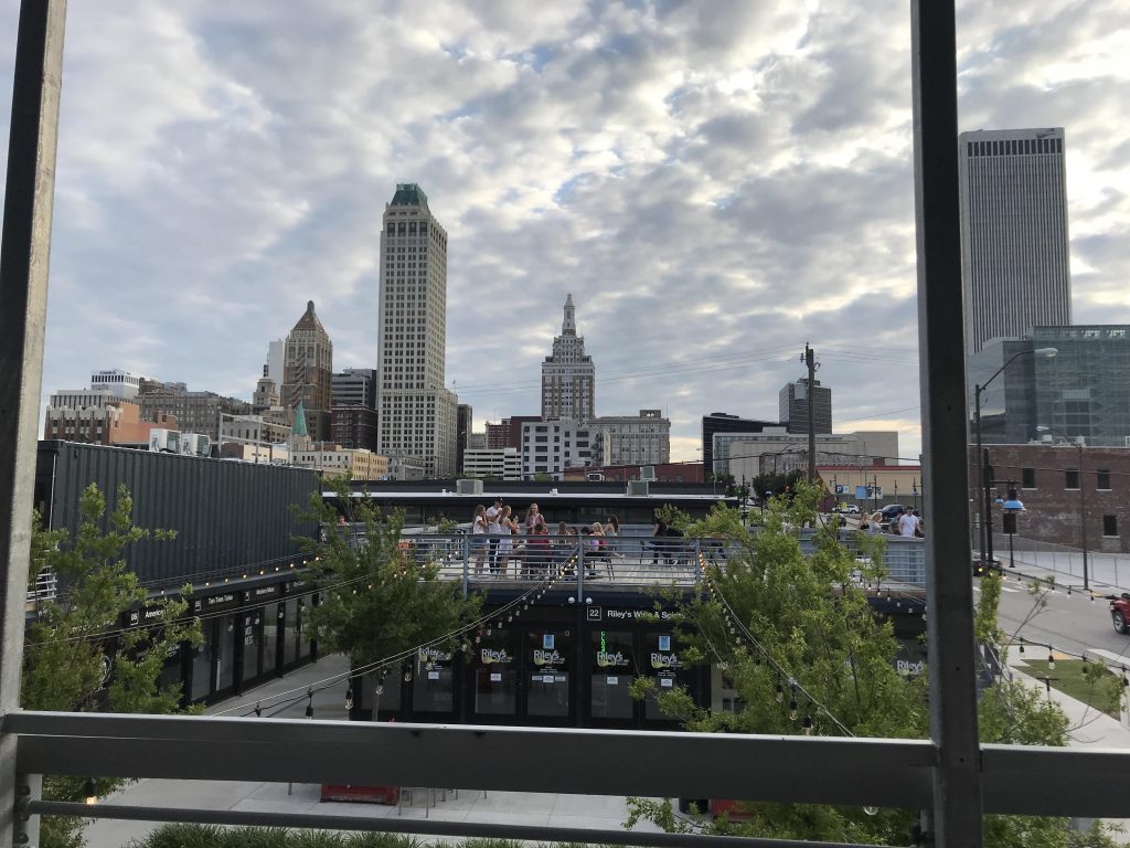
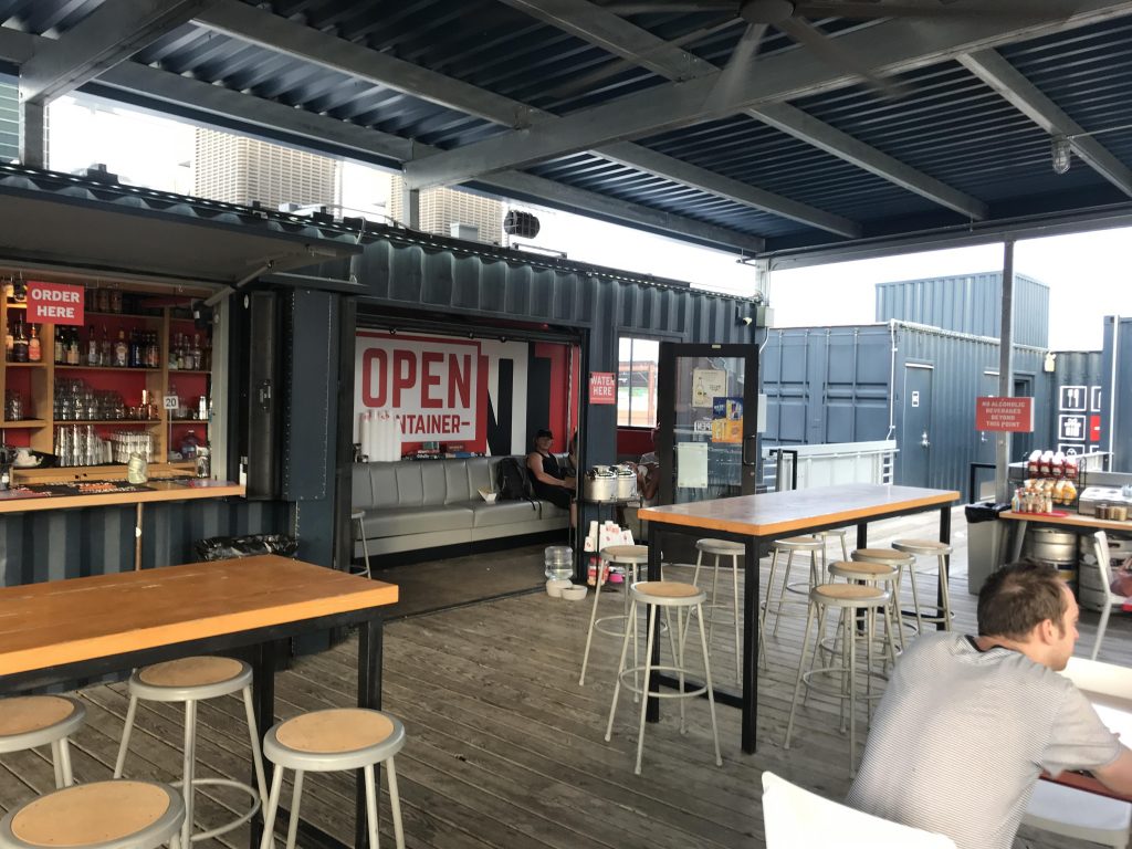
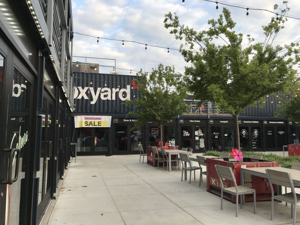
Wound up at a casual joint called Open Container for dinner. It has outdoor covered seating. The place has enormous charm and the food is great. It’s located in the Boxyard, a mini-shopping center made out of shipping containers. Loving my trip.
Downtown Tulsa from Open ContainerOpen Container, Tulsa The Boxyard, Tulsa
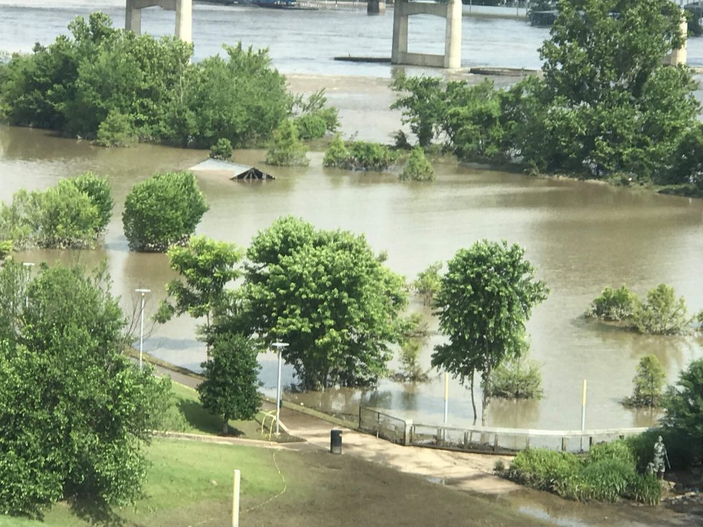
While walking to the Clinton Center, saw some flooded-out areas along the river.
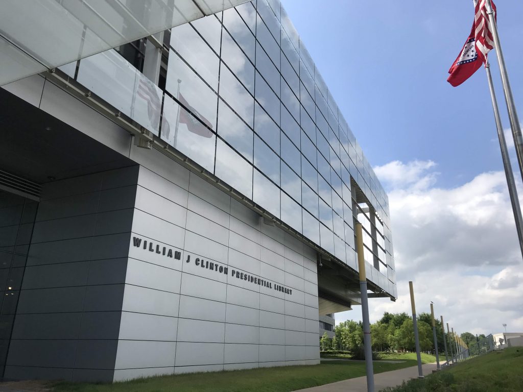
Floods, Little RockThe Clinton Presidential Library, Little Rock
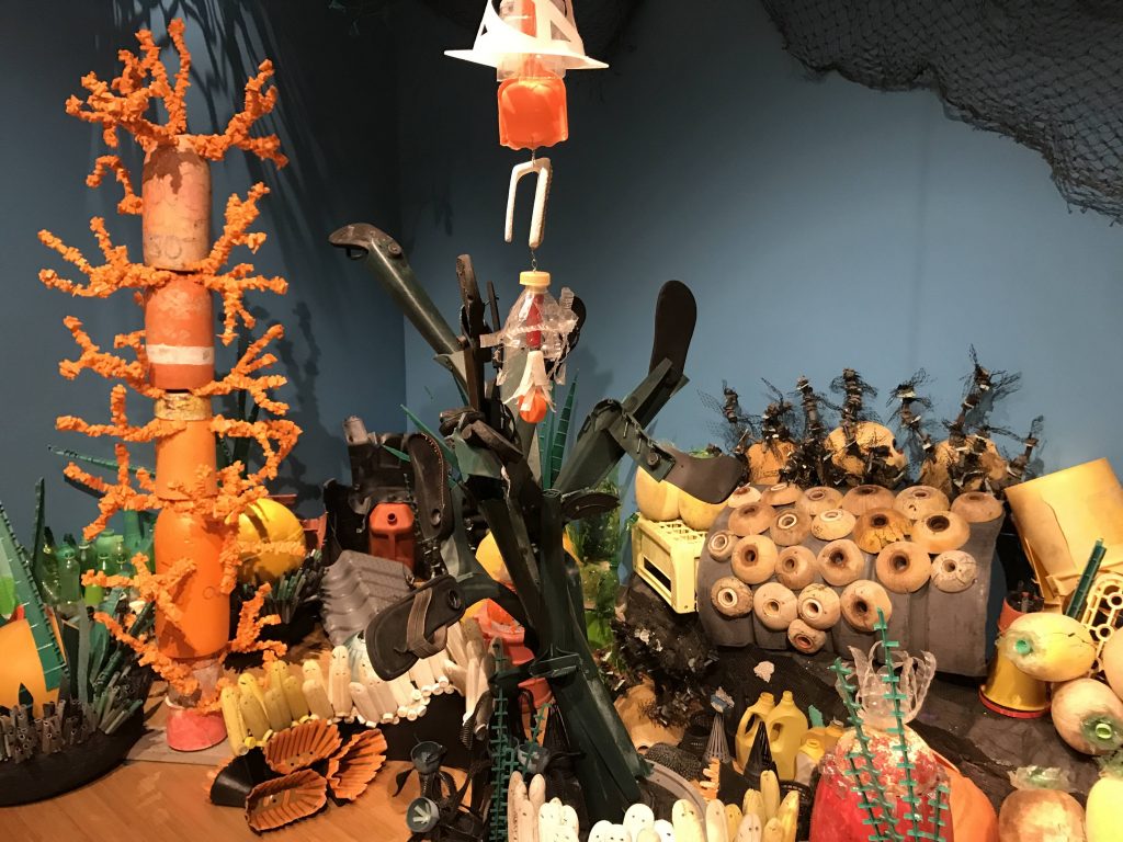
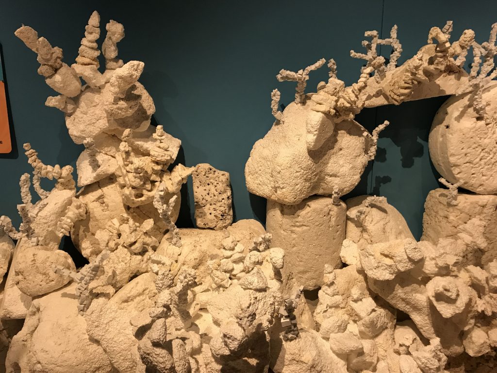
Went to the Clinton Presidential Library. There was a great exhibit called Washed Ashore – art made out of petroleum-based waste found on the beach. Some of the art was playful and some was beautiful. The art was created by a team led by Angela Haseltine Pozzi. Her purpose was to raise awareness of the plastic trash problem.
Trash artFoam trash representing a coral reefThe river and a pedestrian bridge from the Clinton Library
The Clinton exhibits were interesting, but of course, everything was spun to be favorable to Clinton. There is a restaurant there called 42 bar and table. (Wasn’t open for lunch yet.)
Left town.
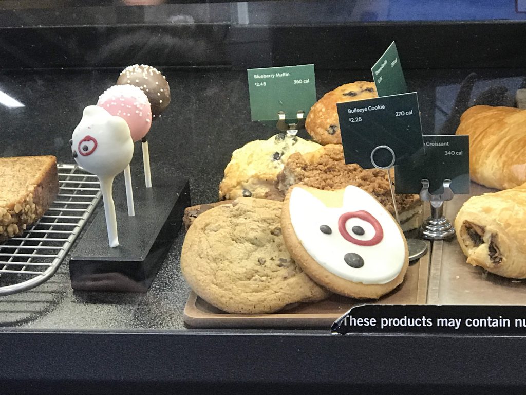
I stopped at a Starbucks inside Target and they had Bullseye cookies!
Went through some scenic parts of Arkansas, including the Ozarks. Realized for the first time that Missouri and Arkansas share the Ozarks.
On I-40 stopped at an overlook, where two trucks were loudly idling, ruining any serenity. Why did they idle?
Arrived at the Doubletree Hotel in Fort Smith, AR. It has an atrium lobby with a waterfall.
According to the official Arkansas tourist guide, I am in the West now.
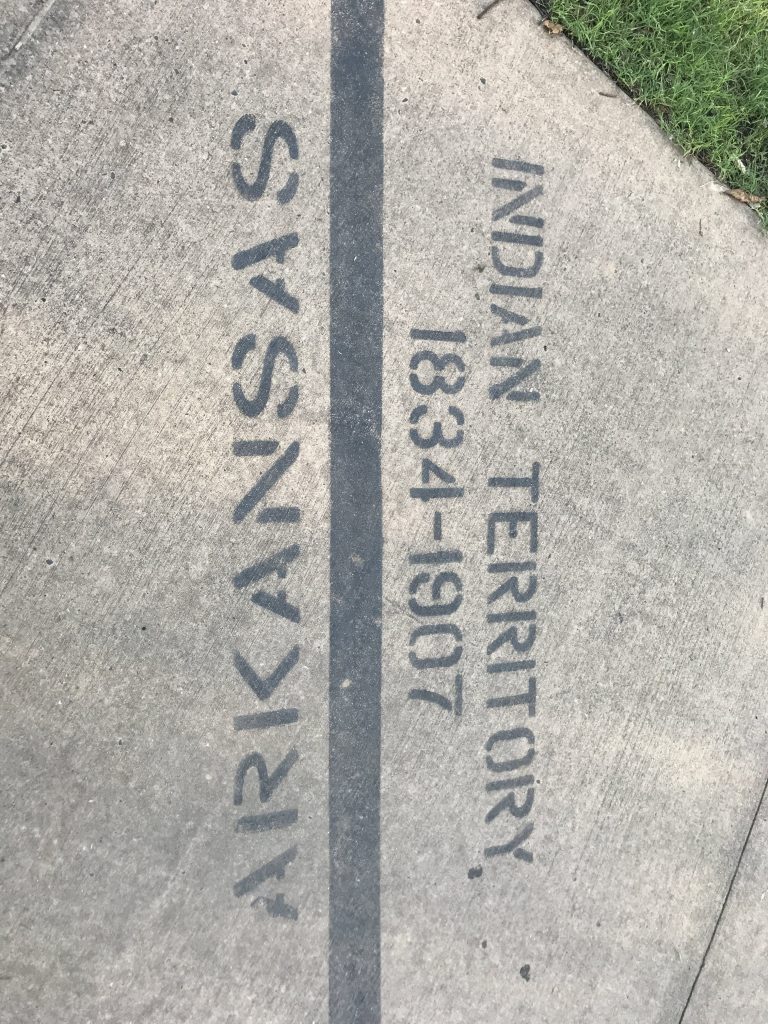
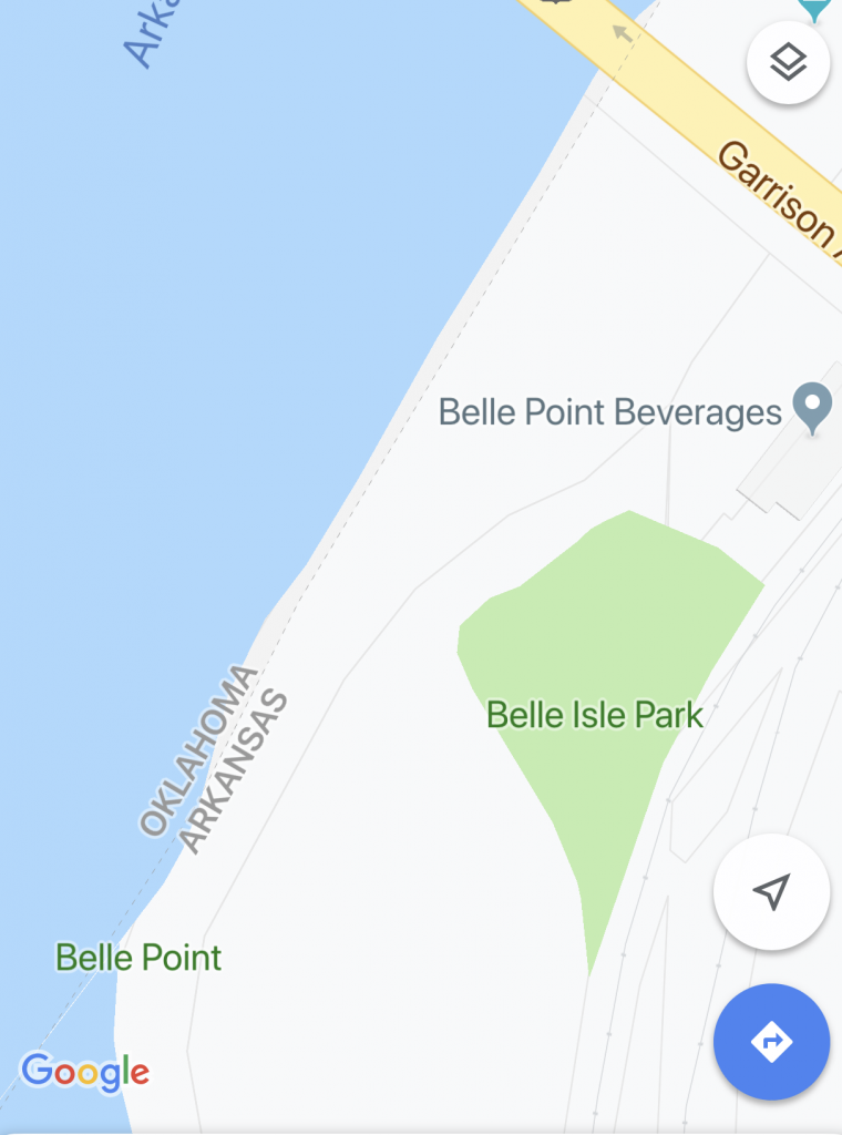
Fort Smith is on the same river as Little Rock, the Arkansas River. The fort was founded in 1817 by the U.S. Army to contain a “volatile Indian feud.” (NPS language from a sign at the Fort Smith National Historic Site.) It’s on the border of what was then Indian Territory, and is now Oklahoma. (More about that story later.) For over 80 years, the federal government used Fort Smith to establish and maintain law and order in the Indian Territory.
Wandered around the National Historic Site and back into town.
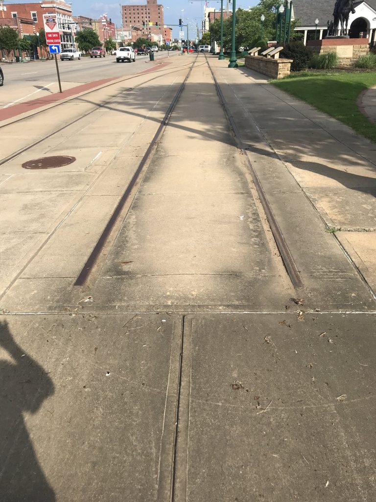
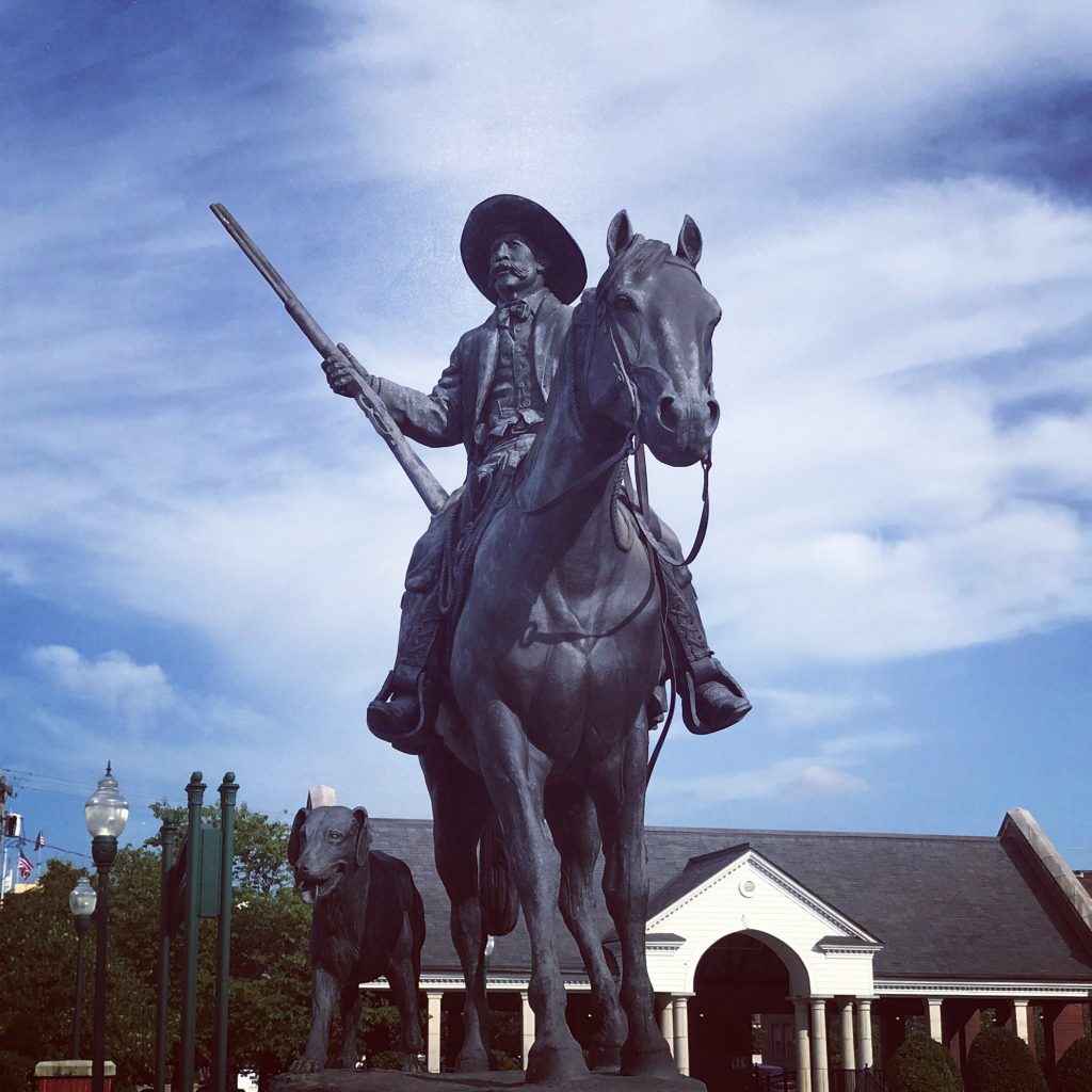
Trolley tracks on the sidewalk that come to a haltA statue of U.S. Deputy Marshal Bass Reeves (1838-1910). He was the first African American deputy U.S. Marshal west of the Mississippi. [Instagram filter added.]
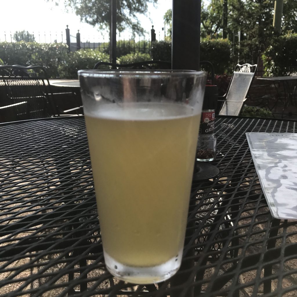
Saw Bricktown Brewery with outside seating and went in. Though it’s called brewery, they don’t have anything brewed here. I ordered a beer called Wiley’s One-Eyed Wheat, brewed in Oklahoma City. I had a near-perfect moment sitting out in the sun.
Wiley’s One-Eyed Wheat
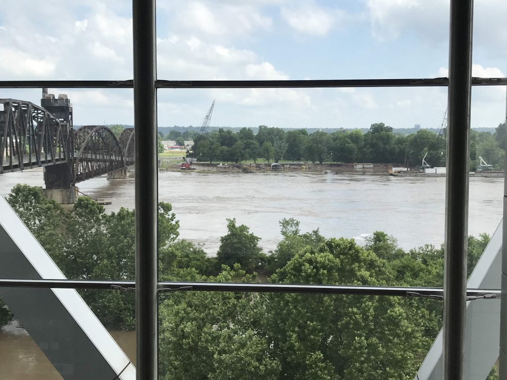
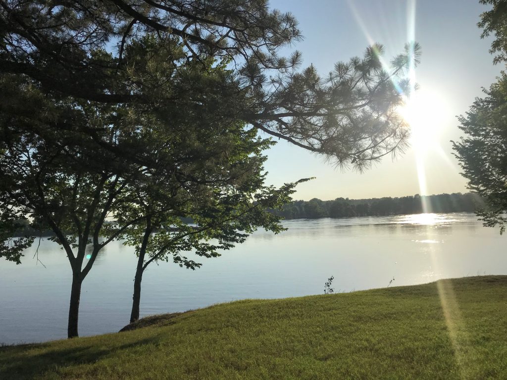
Afterwards, found the riverfront trail, which is beautiful.
Until 1907 the border was here.The Arkansas River, Fort Smith
Does Oklahoma own a tiny strip of land on the Arkansas side of the river? Per Google it looks like they do. Haven’t found confirmation of this.