Enid, OK to Liberal, KS
Finally a beautiful day. It is 75° with humidity 40%. I am out of the punishing heat of the South.
CVS has made this trip a lot easier by being everywhere and having everything.
Still in Enid, I went to the Cherokee Strip Regional Heritage Center. The Cherokee Strip, officially the Cherokee Outlet, was a large area of land in present-day Oklahoma that the US Government obliged the Cherokee Indians to take in exchange for their lands in the Southeast. They were permitted to use the land but not to live there (they lived nearby).
As often happened during the settling of the United States, there arose pressure from whites to settle the land. The Cherokees were forced to sell, and in 1893 there was an enormous land run to allow whites to settle there. Enid itself sits in what was the Cherokee Strip.
First I looked at their awesome exhibition of political posters.
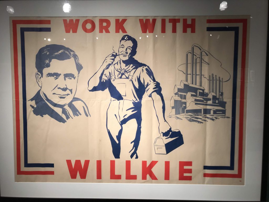
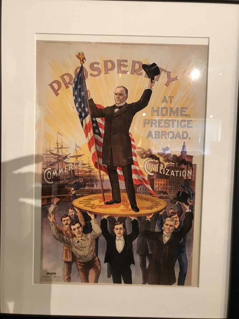
The museum’s permanent exhibition is a lavish and extensive history of the Cherokee Strip and Enid.
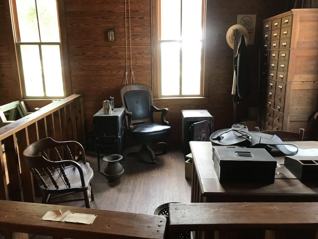
Sometimes people ask me, like they did at the museum, where I’m from. When I tell them, they ask what I’m doing here. So I told them about my trip and they loved it. They introduced me several times as the person from New York. Their archivist, Aaron, gave me a special tour of the historic buildings on the site, including the original Enid land office from the 1890s.
Goodbye, Enid, lovely city where people are so nice. Pushed further west.
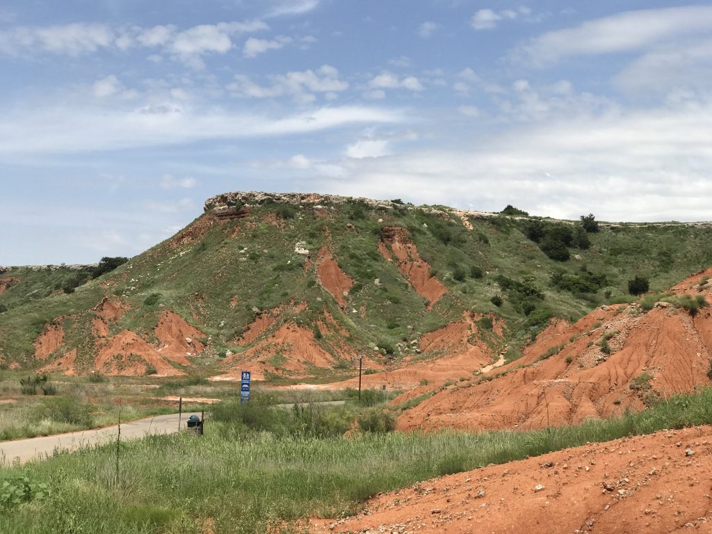
Passed through Gloss Mountains, red mesas that suddenly stick up from the prairie floor.
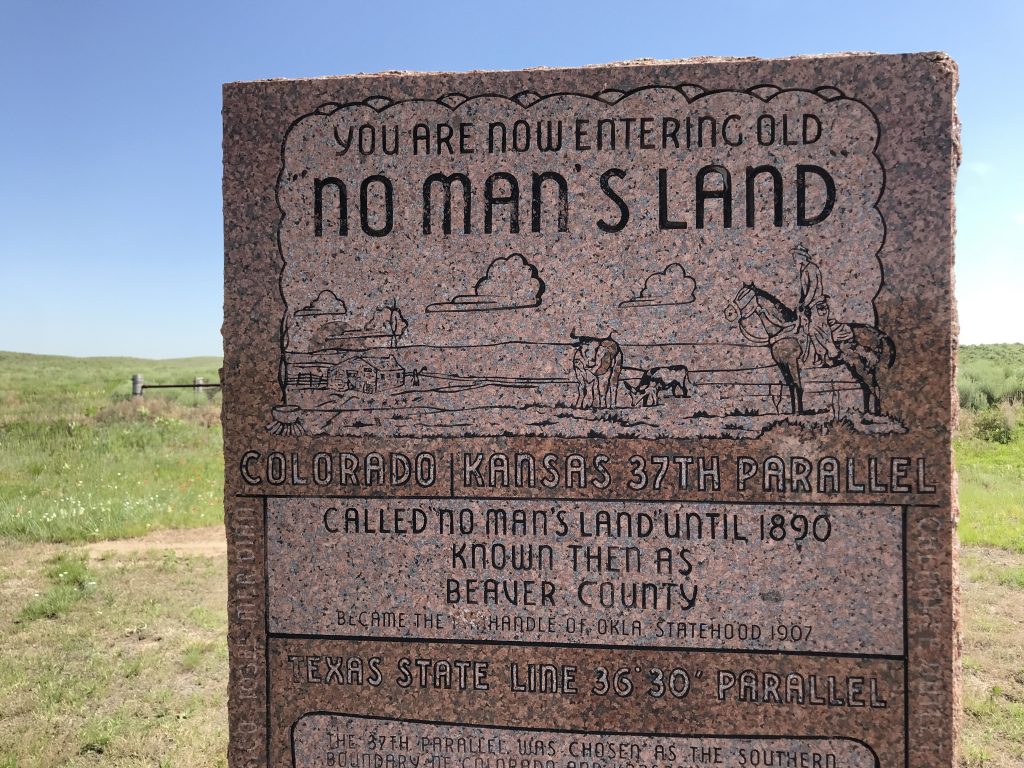
Finally, I entered the Oklahoma Panhandle, one of the main destinations on this trip, and a place I’ve wanted to visit for years. There’s a little monument on US 64 at the Panhandle’s boundary. (Before Oklahoma statehood, the Panhandle was known as No Man’s Land.)
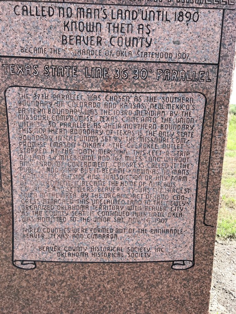
For comparison, Long Island is 118 miles by 23 miles maximum.
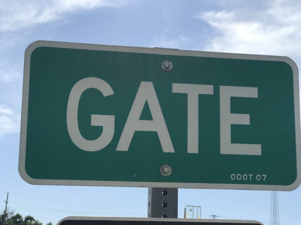
I arrived in Gate, Oklahoma. Stopped there mainly because of its name.
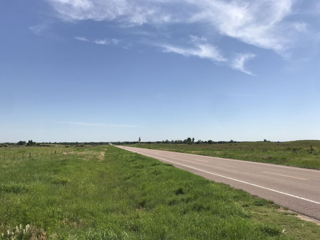
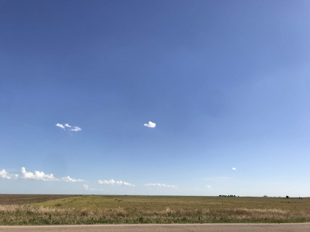
The Panhandle is flat and beautiful and mostly empty.
I entered a surprise new state, Kansas. I went there because the Panhandle is a little short on hotels.
Internet in my room wasn’t working, so I called the front desk and was told the whole town’s internet was down. What, no redundant connection? It was still down when I left in the morning.
Leave a Reply